- Usage in publication:
-
- Horsetooth Member
- Modifications:
-
- Named
- Dominant lithology:
-
- Sandstone
- AAPG geologic province:
-
- Denver basin
Summary:
Named upper member of Lower Cretaceous Muddy Sandstone of Dakota Group. Is 28 feet thick at type; consists of brown-weathering, ridge-forming, fine-grained, well-sorted sandstone, locally interbedded with sandy carbonaceous mudstone. Locally, has abundant carbonaceous wood, clam molds, OPHIOMORPHA burrows. Lower 2 to 13 feet has wedge-shaped sets of cross-strata. Upper part is massive and structureless. Ranges from 1 to 40 feet thick. Overlies Fort Collins Member (new) of Muddy, a sharp, flat, erosional contact. Underlies Mowry Shale, a name extended into area from Wyoming, in preference to use of term Benton Shale. Replaces use of upper sandstone of South Platte Formation, a term restricted in this report to area south of Boulder, Colorado. Has 3 facies: (1) southern facies of cross-stratified sandstone; (2) central facies of large-scale scour and fill, locally ripple, stratified sandstone; (3) northern facies of unburrowed, tabular, ripple-stratified sandstone deposited marginal to the actively prograding central part of delta. Thought to represent a shoal-water delta or alluvial-plain assemblage. Correlates with upper part of "J" sandstone and Newcastle Sandstone. Report includes correlation chart.
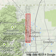
Named from Horsetooth Reservoir, Larimer Co., CO, in the Denver basin. Type section is roadcut 0.15 mi east of Spring Canyon Dam, N/2 SE/4 sec. 32, T. 7 N., R. 69 W.
Source: Modified from GNU records (USGS DDS-6; Denver GNULEX).

- Usage in publication:
-
- Horsetooth Member*
- Modifications:
-
- Overview
- AAPG geologic province:
-
- Denver basin
Summary:
Horsetooth Member of Muddy Sandstone of central CO, Denver basin and Encinal Canyon Member of Dakota Sandstone of Colorado Plateau are probably a single, diachronous, alluvial aggradational unit. Incised valleys beneath Horsetooth (near edge of seaway) and Encinal Canyon (well inland from seaway) were probably part of a single drainage surface. Age difference between Horsetooth and Encinal Canyon is slight; macrofossil and microfossil data, summarized by other workers, support late Albian age for Horsetooth; Encinal Canyon is earliest Cenomanian; almost identical earliest Cenomanian palynomorph suites occur in both Mowry Shale, which overlies Muddy in central CO and in Encinal Canyon in plateau region.
Source: GNU records (USGS DDS-6; Denver GNULEX).
For more information, please contact Nancy Stamm, Geologic Names Committee Secretary.
Asterisk (*) indicates published by U.S. Geological Survey authors.
"No current usage" (†) implies that a name has been abandoned or has fallen into disuse. Former usage and, if known, replacement name given in parentheses ( ).
Slash (/) indicates name conflicts with nomenclatural guidelines (CSN, 1933; ACSN, 1961, 1970; NACSN, 1983, 2005, 2021). May be explained within brackets ([ ]).

