- Usage in publication:
-
- Horsethief formation
- Modifications:
-
- Named
- Dominant lithology:
-
- Quartzite
- Conglomerate
- Limestone
Summary:
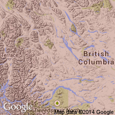
Named for Horsethief Creek between 116 deg, 10 min to 116 deg, 20 min W Long, 50 deg, 30 min to 50 deg, 50 min N lat, Windermere, B.C., CN. No type locality designated. Geologic map. Is the upper formation of the Windermere series. Is exposed along east and west edges of the Purcell Range within the map area. Is mostly gray, green and purple slate with lenticular beds of coarse quartzite and pebble conglomerate, and at several horizons has numerous interbeds of gray, crystalline, mostly nonmagnesian limestone which forms a small part of the formation. The coarse quartzite and pebble beds vary from 20 to 100+ ft thick. Most of the pebbles are quartz and quartzite, but some are limestone, all well sorted and closely packed. A few feldspar grains are present. The pebbles differ in size in different beds; they were derived from the Purcell. Grain size decreases in coarseness from east to west. Is about 4,000 ft east of Mount Law; may be more than 5,000 ft thick near Earl Grey Pass. Was probably deposited in shallow water. Overlies conformably Toby conglomerate and unconformably underlies Upper Cambrian Ottertail formation. Of Precambrian age.
Source: GNU records (USGS DDS-6; Denver GNULEX).
For more information, please contact Nancy Stamm, Geologic Names Committee Secretary.
Asterisk (*) indicates published by U.S. Geological Survey authors.
"No current usage" (†) implies that a name has been abandoned or has fallen into disuse. Former usage and, if known, replacement name given in parentheses ( ).
Slash (/) indicates name conflicts with nomenclatural guidelines (CSN, 1933; ACSN, 1961, 1970; NACSN, 1983, 2005, 2021). May be explained within brackets ([ ]).

