The National Geologic Map Database is migrating to a new infrastructure. We apologize for any service disruptions during this process.
|
|---|


- Usage in publication:
-
- Horseshoe Basin magma series [informal]
- Modifications:
-
- Named
- Geochronologic dating
- Dominant lithology:
-
- Quartz monzonite
- Granodiorite
- Quartz diorite
- Diorite
- Gabbro
- AAPG geologic province:
-
- Okanogan province
Summary:
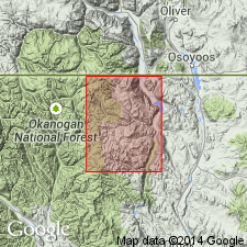
/Horseshoe Basin magma series [informal]. Mapped in Toats Coulee Creek region, Okanogan Range, Washington. Includes: Cathedral Leuco Quartz Monzonite, Horseshoe Mountain Porphyritic Leuco Quartz Monzonite, Similkameen Sub-porphyritic Granodiorite, Anderson Creek granodiorite (informal), Bowers Quartz Diorite (new), Edwards Slough Diorite (new) and Goat Gabbro (new). Consists of gneissose and non-gneissose groups of plutons. Characterized by typically magmatic textures and discordant relationships with older metamorphic and plutonic units. Age is Early to medial Cretaceous, based on radiometric (K-Ar, biotite) ages of 106.5 +/-6.8 Ma from the Anderson Creek granodiorite and 94.0 +/-2.8 Ma from the Cathedral Leuco Quartz Monzonite.
Type locality stated to be in T. 38 through 40 N., and R. 23 through 25 E., Okanogan Co., WA.
["Horseshoe Basin magma series" considered informal. Term "Series" is applied formally only to chronostratigraphic units (ACSN, 1961, 1970; NACSN, 1983, 2005, 2021). US geologic names lexicon, USGS Bull. 1520, p. 141, lists both Horseshoe Basin Magma Series and Horseshoe Basin Group (explanation not given).]
Source: GNU records (USGS DDS-6; Menlo GNULEX); US geologic names lexicon (USGS Bull. 1520, p. 141).
For more information, please contact Nancy Stamm, Geologic Names Committee Secretary.
Asterisk (*) indicates published by U.S. Geological Survey authors.
"No current usage" (†) implies that a name has been abandoned or has fallen into disuse. Former usage and, if known, replacement name given in parentheses ( ).
Slash (/) indicates name conflicts with nomenclatural guidelines (CSN, 1933; ACSN, 1961, 1970; NACSN, 1983, 2005, 2021). May be explained within brackets ([ ]).