


- Usage in publication:
-
- Horse Spring formation*
- Modifications:
-
- Named
- Dominant lithology:
-
- Silt
- Clay
- Sand
- Salt
- Gypsum
- AAPG geologic province:
-
- Plateau sedimentary province
Summary:
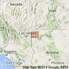
Proposed as a name for exposures near Horse Spring in the Virgin Mountains of Clark Co, NV in the Great Basin province and north of the Colorado River west of Grand Wash in Mohave Co, AZ in the Plateau sedimentary province. No type locality designated. No fossils found. Consists of silt, clay, sand, and in the Virgin Valley beds of rock salt 50 to more than 100 ft thick present. Gypsum layers common throughout. Has a maximum thickness of nearly 2,000 ft. Considered to be of late Miocene age on basis of correlation with Siebert and Esmeralda formations. Geologic map; nomenclature table. Overlies Overton fanglomerate (new). Is older than some unnamed Pliocene sedimentary rocks.
Source: GNU records (USGS DDS-6; Denver GNULEX).
- Usage in publication:
-
- Horse Spring formation*
- Modifications:
-
- Overview
- Dominant lithology:
-
- Limestone
- Sandstone
- AAPG geologic province:
-
- Plateau sedimentary province
- Great Basin province
Summary:
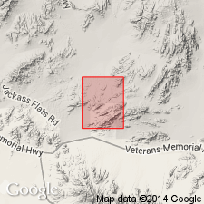
Mapped in White basin, on east side Tramp Ridge, and east of Bluff Spring, Clark Co, NV in the Great Basin province, and north of Black Canyon, Mohave Co, AZ in the Plateau sedimentary province. Geologic map. Measured sections. Is 395.5 ft thick in Horse Spring Valley where it overlies Overton fanglomerate and consists of (ascending) basal gray limestone, green conglomeratic sandstone and conglomerate, and interbedded white to gray dense, hard limestone and two thin gray calcareous sandstone beds. In section 2.5 miles northeast of Mud Well to north of Horse Spring, the formation is 583.5 ft thick and is underlain by the Overton and overlain by the Muddy Creek formation. In Kaolin Wash, east of the Muddy Mountains, the formation is 1,237 ft thick; the Kaolin section is in the magnesite facies of Horse Spring. Tuff layers present in most every section. Basal contact usually gradational; upper contact erosional. No fossils. Of late Miocene age because 1) its similarity to other late Miocene lacustrine deposits that contain abundant tuff, 2) subject to only one period of folding; 3) presence of magnesian carbonate which is found in other deposits of this age nearby.
Source: GNU records (USGS DDS-6; Denver GNULEX).
- Usage in publication:
-
- Horse Spring Formation*
- Modifications:
-
- Age modified
- Geochronologic dating
- AAPG geologic province:
-
- Great Basin province
Summary:
Age of the Horse Spring Formation in the Mercury quadrangle is Oligocene based on a radiometric (biotite) age of 29.3 +/-0.9 Ma. Miocene age applies to Lake Mead area only.
Source: GNU records (USGS DDS-6; Menlo GNULEX).
- Usage in publication:
-
- Horse Spring Formation*
- Modifications:
-
- Areal extent
- AAPG geologic province:
-
- Great Basin province
Summary:
Unit is geographically extended into the report area [as the Rainbow Garden Member]. Age is given as Miocene.
Source: GNU records (USGS DDS-6; Menlo GNULEX).

- Usage in publication:
-
- Horse Spring Formation*
- Modifications:
-
- Principal reference
- Revised
- Geochronologic dating
- AAPG geologic province:
-
- Great Basin province
- Plateau sedimentary province
Summary:
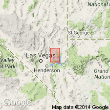
Revised to include Tertiary rocks below the unnamed red sandstone unit and unconformably above rocks that belong to formations as old as Kaibab Limestone to those as young as the Baseline Sandstone. The red sandstone unit was assigned to the upper parts of the 1) Horse Spring Formation, 2) Gale Hills Formation (a name abandoned in this report), or 3) Muddy Creek Formation in earlier reports. Principal reference area (lithology not described) designated in Bitter Spring Valley and White Basin area, Clark Co, NV; principal reference section (lithology not described) 2,100 m thick designated between long 114 deg 36' and 114 deg 37' W and lat 36 deg 15' 45" and 36 deg 19' 30" N Muddy Peak quad. Divided into (ascending order): Rainbow Gardens Member (new), Thumb Member (reduced in stratigraphic rank), Bitter Ridge Limestone (new) and Lovell Wash (new) Members. Areal limit maps of Rainbow Gardens (Clark Co, NV and Mohave Co, AZ), Thumb (Clark Co, NV), Bitter Ridge (Clark Co, NV), and Lovell Wash (Clark Co, NV). Clark Co is in the Great Basin province. Mohave Co is in the Plateau sedimentary province. Rainbow Gardens has not been dated but is thought to be no older than about 20 m.y. Thumb ranges from 17.2 to 13.5 m.y. Bitter Ridge ranges from 13.5 to 13.0 m.y. Lovell Wash ranges from 13.0 to 11.9 m.y. Tables show data on K-Ar ages and Zr-F-T ages on samples from members. Paleogeologic maps. Stratigraphic diagram.
Source: GNU records (USGS DDS-6; Denver GNULEX).
- Usage in publication:
-
- Horse Spring Formation*
- Modifications:
-
- Age modified
- Geochronologic dating
- AAPG geologic province:
-
- Great Basin province
Summary:
Age of the Horse Spring Formation in the southern Virgin Mountains is revised from Miocene to: late Oligocene and Miocene, based in part, on a radiometric age (K-Ar, biotite) of 24.3 Ma from the Rainbow Gardens Member (middle part).
Source: GNU records (USGS DDS-6; Menlo GNULEX).
For more information, please contact Nancy Stamm, Geologic Names Committee Secretary.
Asterisk (*) indicates published by U.S. Geological Survey authors.
"No current usage" (†) implies that a name has been abandoned or has fallen into disuse. Former usage and, if known, replacement name given in parentheses ( ).
Slash (/) indicates name conflicts with nomenclatural guidelines (CSN, 1933; ACSN, 1961, 1970; NACSN, 1983, 2005, 2021). May be explained within brackets ([ ]).