- Usage in publication:
-
- Horny Toad Terrace deposits
- Modifications:
-
- Named
- Dominant lithology:
-
- Gravel
- Sand
- Silt
- AAPG geologic province:
-
- Basin-and-Range province
Summary:
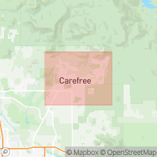
Named [informally] for Horny Toad Restaurant (Cave Creek area eatery of long standing), which in turn is named after native horny toad (PHRYNOSOMA). Distinctive terrace deposits seen at type locality approx 0.30 mi west of Vermeersch Rd and 200 feet north of Cave Creek Rd on right edge of Galloway Wash, 200 feet northwest of restaurant, Cave Creek quad, northern Maricopa Co., central AZ. Deposits extend from just north of Lone Mountain to Cave Creek and run parallel and 10 to 60 feet above modern stream channel of White Eagle Wash. Consist of tan, weakly calichified, well stratified, moderately to poorly sorted, unconsolidated, grus-rich mix of 52% gravel, 46% sand, and 2% silt with subangular and subrounded granite clasts. Exposed thickness at least 5 feet; lithologic logs from wells 139 and 140 near downtown Cave Creek show 30 to 60 feet maximum thickness. Deposits become strath terrace in vicinity of Lone Mountain where they overlie Middle Proterozoic (1400 Ma) Camelback Granite (new) as well as near Cave Creek where they cut Precambrian meta-argillite--phyllite complex and Miocene volcanic rocks. In central Carefree basin, deposits change to fill terrace as they cut late Miocene and early Pliocene Church, Galloway, Sombrero, and Grapevine Members of Carefree Formation (all new). Grade into Pleistocene Cahava Ranch Terrace deposits (new, [informal]) indicating both to be of similar age, which is Pleistocene. Thought to correlate with Blue Point Terrace of late Cenozoic Salt River (Pewe, 1978). Report includes geologic map and cross section, and stratigraphic nomenclature table.
Source: GNU records (USGS DDS-6; Denver GNULEX).
For more information, please contact Nancy Stamm, Geologic Names Committee Secretary.
Asterisk (*) indicates published by U.S. Geological Survey authors.
"No current usage" (†) implies that a name has been abandoned or has fallen into disuse. Former usage and, if known, replacement name given in parentheses ( ).
Slash (/) indicates name conflicts with nomenclatural guidelines (CSN, 1933; ACSN, 1961, 1970; NACSN, 1983, 2005, 2021). May be explained within brackets ([ ]).

