The National Geologic Map Database is migrating to a new infrastructure. We apologize for any service disruptions during this process.
|
|---|


- Usage in publication:
-
- Hoppin slate*
- Modifications:
-
- Original reference
- Dominant lithology:
-
- Shale
- Slate
- Limestone
- Quartzite
- AAPG geologic province:
-
- New England province
Summary:
Pg. 36. Hoppin slate. Chiefly red shale or slate, with layers and nodules of white limestone, overlying greenish shale or slate, beneath which is a basal white quartzite. Not greatly altered. Lower Cambrian fossils. Thickness probably not less than 600 feet; base not seen. Exposed at two places in Narragansett Basin, one at Hoppin Hill, and the other in Wrentham, 0.5 mile south of West Wrentham village, just north of Rhode Island boundary. Overlapped by Wamsutta formation (Carboniferous). Age is Early Cambrian.
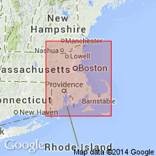
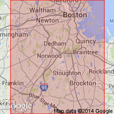
[Named from exposures on Hoppin Hill, North Attleboro, eastern MA.]
Source: US geologic names lexicon (USGS Bull. 896, p. 980).
- Usage in publication:
-
- Hoppin Formation*
- Modifications:
-
- Revised
- Redescribed
- AAPG geologic province:
-
- New England province
Summary:
Hoppin Slate of Emerson (1917) is renamed Hoppin Formation because rock is not strictly a slate and contains limestone, shaly limestone, sandstone, and conglomeratic quartzite. [Age is changed to Early and Middle Cambrian; explanation is probably in Lyons (1984), prepared before this report was compiled, according to GNC records.]
Source: GNU records (USGS DDS-6; Reston GNULEX).

- Usage in publication:
-
- Hoppin Formation*
- Modifications:
-
- Overview
- AAPG geologic province:
-
- New England province
Summary:
Used as Hoppin Formation of Early and Middle Cambrian age. Contains Middle Cambrian fauna.
Source: GNU records (USGS DDS-6; Reston GNULEX).
- Usage in publication:
-
- Hoppin Formation†
- Modifications:
-
- Abandoned
- AAPG geologic province:
-
- New England province
Summary:
Hoppin Formation in MA and Pirate Cave Formation in RI are local designations for Weymouth Formation and use of these names should be discontinued. A basal white quartzite of the original Hoppin Slate is here named the North Attleboro Formation.
Source: GNU records (USGS DDS-6; Reston GNULEX).
- Usage in publication:
-
- Hoppin Formation*
- Modifications:
-
- Overview
- AAPG geologic province:
-
- New England province
Summary:
Hoppin Formation consists of green and red slaty shale, locally containing calcareous nodules, and lenses of red argillaceous limestone; arkosic quartzite (locally conglomeratic) and sandstone occur at base of formation. Nonconformity at base of formation over Dedham Granite is clearly exposed at Hoppin Hill; Early Pennsylvanian Pondville Conglomerate lies with angular unconformity above. Maximum thickness is approx 244 m. Age is Early and Middle Cambrian. Report includes geologic maps, measured sections, and correlation charts. [Chapters A-J in U.S. Geological Survey Professional Paper 1366 are intended as explanations and (or) revisions to 1:250,000-scale MA State bedrock geologic map of Zen and others (1983).]
Source: GNU records (USGS DDS-6; Reston GNULEX).
- Usage in publication:
-
- Hoppin Formation*
- Modifications:
-
- Age modified
- AAPG geologic province:
-
- New England province
Summary:
Age of Weymouth and Hoppin Formations is Early Cambrian based on conoidal and olenellid fauna.
Source: GNU records (USGS DDS-6; Reston GNULEX).
For more information, please contact Nancy Stamm, Geologic Names Committee Secretary.
Asterisk (*) indicates published by U.S. Geological Survey authors.
"No current usage" (†) implies that a name has been abandoned or has fallen into disuse. Former usage and, if known, replacement name given in parentheses ( ).
Slash (/) indicates name conflicts with nomenclatural guidelines (CSN, 1933; ACSN, 1961, 1970; NACSN, 1983, 2005, 2021). May be explained within brackets ([ ]).