- Usage in publication:
-
- Hopi Sandy Member
- Modifications:
-
- Named
- Biostratigraphic dating
- Dominant lithology:
-
- Sandstone
- Shale
- Claystone
- AAPG geologic province:
-
- Black Mesa basin
- Plateau sedimentary province
Summary:
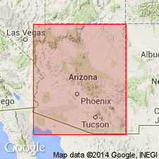
Is named as a formal member of the Upper Cretaceous Mancos Shale. Type section: NW1/4 NW1/4 SE1/4 SE1/4 sec 36, T30N, R13E, on east side of Ha Ho No Geh Canyon on northwest side of Howell Mesa, Hopi Indian Reservation, Coconino Co, AZ (Plateau sedimentary province). At type, member is 12 m thick and top of member is 51 m below top of Mancos. Member ranges from 12 to 22 m thick across Black Mesa, thickening from southwest to northeast. Base of member is placed where thin, fine-grained sandstone becomes common (every 10 to 20 cm) just above highest calcareous shale. Upper contact placed where thin sandstones rapidly disappear, generally just above the most prominent sandstone in the member. Sandstone units are fine to very fine grained, subfeldspathic to feldspathic, yellowish-gray (5Y7/2) arenites; grains are angular, with calcite replacing much of the feldspar; fine mica grains and plant debris often abundant along bedding planes. In southwest, member comprised of two coarsening-upward sequences that form a two-tiered bluff; to north and northeast, only one coarsening-upward sequence is apparent. Interpreted to have been deposited in a shelf environment within the reach of storm wave-base; significant sand bodies a Blue Point may reflect a subtle topographic high; shoreline was to the southwest; two progradational sequences are recorded in the southwest. Is present across Black Mesa area, Navajo and Apache Cos, northeast AZ (Black Mesa basin). Assigned to the middle Turonian COLLIGNONICERAS WOOLLGARI Zone as the nominate ammonite is the dominant fossil.
Source: GNU records (USGS DDS-6; Denver GNULEX).
For more information, please contact Nancy Stamm, Geologic Names Committee Secretary.
Asterisk (*) indicates published by U.S. Geological Survey authors.
"No current usage" (†) implies that a name has been abandoned or has fallen into disuse. Former usage and, if known, replacement name given in parentheses ( ).
Slash (/) indicates name conflicts with nomenclatural guidelines (CSN, 1933; ACSN, 1961, 1970; NACSN, 1983, 2005, 2021). May be explained within brackets ([ ]).

