

- Usage in publication:
-
- Hoot Nanny Olivine Basalt
- Modifications:
-
- Named
- Dominant lithology:
-
- Basalt
- Tuff
- Breccia
- AAPG geologic province:
-
- Snake River basin
Summary:
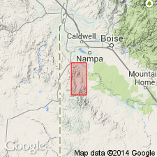
Named for Hoot Nanny Ranch in sec 24, T2S, R4W, Owyhee Co, ID, Snake River basin. Type locality is draw southwest of Windy Peak, secs 20 and 21, T2S, R3W. Is one of eight units of Reynolds Basin Group (new), which is of late Miocene or early Pliocene age. Very poorly exposed, but widely distributed in the map area. Characterized by basalt flows containing poikilitic grains or clinopyroxene several mm to several cm in diameter. Greatest known thickness attained along east side of Reynolds Basin south of Windy Point, where is 3,100 ft thick. Mode of weathering and quality of outcrops varies considerably, from a brown or reddish-brown surficial mantle as much as 10 ft thick (in low altitude and precipitation areas) to bare, isolated ledges at higher elevations. Most distinctive rock type in unit contains large pyroxene phenocrysts (best seen on weathered surfaces), weathering grayish-orange. Crude columnar jointing is transected by a very imperfectly developed horizontal fracture system. In some flows, particularly where fine grained, jointing is highly irregular and blocky. Flow tops, where exposed in ravines, are highly vesicular and often colored red, purple, and blue--may be filled with calcite. Fresh rock usually dark gray, and appears finely crystalline. Red and purple breccias also part of unit locally; thin layers of vitric tuff also encountered locally. Overlies Cretaceous granitic rock and Salmon Creek Volcanics.
Source: GNU records (USGS DDS-6; Denver GNULEX).
For more information, please contact Nancy Stamm, Geologic Names Committee Secretary.
Asterisk (*) indicates published by U.S. Geological Survey authors.
"No current usage" (†) implies that a name has been abandoned or has fallen into disuse. Former usage and, if known, replacement name given in parentheses ( ).
Slash (/) indicates name conflicts with nomenclatural guidelines (CSN, 1933; ACSN, 1961, 1970; NACSN, 1983, 2005, 2021). May be explained within brackets ([ ]).