The National Geologic Map Database is migrating to a new infrastructure. We apologize for any service disruptions during this process.
|
|---|


- Usage in publication:
-
- Hookton formation
- Modifications:
-
- Original reference
- Dominant lithology:
-
- Gravel
- Sand
- Silt
- Clay
- AAPG geologic province:
-
- Eel River basin
Summary:
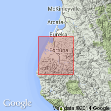
Pg. 13 (fig. 3), 57-63, pls. 1, 2. Hookton formation. Sediments include gravel, sand, silt, and clay; characteristically yellow-orange in color. Thickness as much as 400 feet. Stratigraphically below, though not in contact with, Rohnerville formation (new); unconformably overlies Carlotta formation (new) of Wildcat Group. Poorly preserved fossils, notably pelecypods CARDIUM sp. and MACOMA sp. No positive age established for formation; inferences suggest that it is probably middle to upper Pleistocene. [Columnar section shows Pleistocene; map bracket shows upper Pleistocene.]
Named from Hookton-Table Bluff area where there are numerous, more or less typical, random exposures. Area of study, Eel River Valley, Humboldt Co., northwestern CA. Exposed on north and south sides of Eel River syncline; passes over Tompkins Hill anticline where folding has been more intense.
Source: US geologic names lexicon (USGS Bull. 1200, p. 1799-1800).
For more information, please contact Nancy Stamm, Geologic Names Committee Secretary.
Asterisk (*) indicates published by U.S. Geological Survey authors.
"No current usage" (†) implies that a name has been abandoned or has fallen into disuse. Former usage and, if known, replacement name given in parentheses ( ).
Slash (/) indicates name conflicts with nomenclatural guidelines (CSN, 1933; ACSN, 1961, 1970; NACSN, 1983, 2005, 2021). May be explained within brackets ([ ]).