

- Usage in publication:
-
- Hoodoo Formation
- Modifications:
-
- Named
- Dominant lithology:
-
- Siltstone
- Shale
- AAPG geologic province:
-
- Alaska Peninsula province
- Alaska Southwestern region
Summary:
Pt. 1, p. 59-63, 180, 182; Pt. 2, maps. Hoodoo Formation. In type area, consists almost entirely of black to dark-gray well-bedded siltstone and silty shale, with some claystone, clay shale, and small amounts of very fine-grained sandstone. Thickness at least 2,000 feet and perhaps as much as 3,000 feet. Complete and undisturbed sequence of formation not found anywhere in Alaska Peninsula. Conformably overlies Chignik Formation; unconformably underlies early Tertiary strata. Fossils obtained from unit indicate Campanian to early Maestrichtian age (D.L. Jones). Age is considered to be late Campanian to early Maestrichtian.
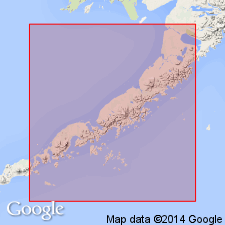
Type section: exposures southeast of Hoodoo Mountain and along west side of Beaver Valley, Port Moller-Pavlof Bay area, Alaska Peninsula, southwestern AK. Eastward from type area formation crops out almost continuously for 25 mi, nearly to Chicagof Peak, and is folded locally into series of complex warps.
Source: US geologic names lexicon (USGS Bull. 1350, p. 341-342); supplemental information from GNU records (USGS DDS-6; Menlo GNULEX).
- Usage in publication:
-
- Hoodoo Formation*
- Modifications:
-
- Adopted
- Overview
- AAPG geologic province:
-
- Alaska Peninsula province
- Alaska Southwestern region
Summary:
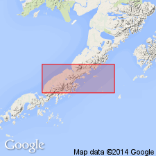
Hoodoo Formation (Burk, 1965) is herein adopted. Mapped in Chignik and Sutwik Island quads in areas near present Pacific Ocean coastline. Sandstone beds and overlying siltstone and shale are characteristic of turbidite deposition in deep water. Is 500 m thick. Conformably overlies Chignik Formation. Unconformably underlies Tolstoi Formation. Age is early Maestrichtian on basis of ammonites and pelecypods (D.L. Jones, written commun., 1979)
Source: GNU records (USGS DDS-6; Menlo GNULEX).
- Usage in publication:
-
- Hoodoo Formation*
- Modifications:
-
- Reference
- AAPG geologic province:
-
- Alaska Peninsula province
- Alaska Southwestern region
Summary:
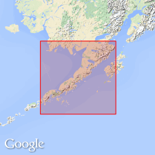
Hoodoo Formation. Reference section designated on ridge north of Foot Bay, starting in southwest corner of sec. 30 and continuing south along west border of sec. 31, T. 47 S., R. 60 W., Chignik A-3 quadrangle (scale 1:63,360), southwestern Alaska. Partial reference section is 630 m thick. Unconformably underliesTolstoi Formation.
Source: Modified from GNU records (USGS DDS-6; Menlo GNULEX).
For more information, please contact Nancy Stamm, Geologic Names Committee Secretary.
Asterisk (*) indicates published by U.S. Geological Survey authors.
"No current usage" (†) implies that a name has been abandoned or has fallen into disuse. Former usage and, if known, replacement name given in parentheses ( ).
Slash (/) indicates name conflicts with nomenclatural guidelines (CSN, 1933; ACSN, 1961, 1970; NACSN, 1983, 2005, 2021). May be explained within brackets ([ ]).