The National Geologic Map Database is migrating to a new infrastructure. We apologize for any service disruptions during this process.
|
|---|


- Usage in publication:
-
- Honey Creek limestone member
- Modifications:
-
- Original reference
- Dominant lithology:
-
- Limestone
- AAPG geologic province:
-
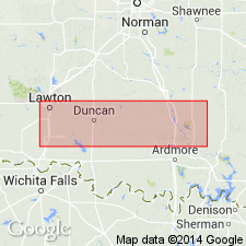
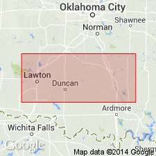
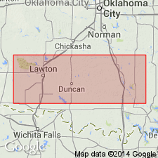
- South Oklahoma folded belt
- Ouachita folded belt
Summary:
Pg. 624, 642, 661, 666, pl. 27. Honey Creek limestone member of Reagan sandstone. Certain thin limestones originally included in basal part of Arbuckle limestone but now transferred to underlying Reagan formation. Is calcareous upper part of the Reagan. [Thickness and type locality not stated.]
Source: US geologic names lexicon (USGS Bull. 896, p. 976).
- Usage in publication:
-
- Honey Creek formation
- Modifications:
-
- Revised
- Biostratigraphic dating
- AAPG geologic province:
-
- South Oklahoma folded belt
- Ouachita folded belt
Summary:
Proposes raising in rank to formation the calcareous beds at top of Reagan sandstone formerly called Honey Creek limestone member of Reagan. Occurs in Arbuckle and Wichita Mountains, South Oklahoma folded belt province. Type section is in sec 1, T2S, R1E along Honey Creek, Carter Co, OK. Consists of yellowish, thin-bedded, argillaceous and shaly limestone. Contains a PLYCHASPIS zone above a fossiliferous crystalline limestone. Thickness is 124-250 ft. Unconformably underlies Fort Sill formation or Royer formation. Corresponds to Wilberns formation in TX. Cap Mountain formation, which underlies Wilberns formation in TX, is absent in OK except at one locality. Honey Creek at that locality overlies Reagan. Age is Late Cambrian.
Source: GNU records (USGS DDS-6; Denver GNULEX).
- Usage in publication:
-
- Honey Creek formation
- Modifications:
-
- Revised
- AAPG geologic province:
-
- South Oklahoma folded belt
- Ouachita folded belt
Summary:
Included as upper formation of Timbered Hills group in Arbuckle and Wichita Mountains, OK, in South Oklahoma folded belt province. Detailed lithology of type section from base: 16 ft of sandstones and limestones alternate with shaly zone at base; 4 ft of gray crystalline limestone; 19 ft of gray-brown, coarsely crystalline limestone with glauconite, shaly beds towards base; 7 ft of crystalline limestones; 25 ft of coarsely crystalline limestone with shaly lenses; and crystalline limestones with abundant glauconite at top. Trilobites in limestones. Gradational to underlying Reagan sandstone. Underlies with marked difference Fort Sill formation of Arbuckle group. Age is Late Cambrian.
Source: GNU records (USGS DDS-6; Denver GNULEX).
- Usage in publication:
-
- Honey Creek formation
- Modifications:
-
- Biostratigraphic dating
- AAPG geologic province:
-
- South Oklahoma folded belt
Summary:
Trilobite fauna is described, in South Oklahoma folded belt province, OK, and used to make correlations with formations in upper Mississippi Valley. Correlations chart. Age is Late Cambrian.
Source: GNU records (USGS DDS-6; Denver GNULEX).
- Usage in publication:
-
- Honey Creek formation
- Modifications:
-
- Revised
- Redescribed
- Dominant lithology:
-
- Limestone
- Dolomite
- Sandstone
- AAPG geologic province:
-
- South Oklahoma folded belt
Summary:
In Wichita and Arbuckle Mountains of OK, in South Oklahoma folded belt province, on the basis of faunal evidence and stratigraphic position, Cap Mountain formation equivalent of Ulrich, 1932 and the basal limestone of Decker, 1939 are included as part of Honey Creek formation. Honey Creek described as mainly limestone, including some dolomites, except in Wichita Mountains where abundant sandstones are interbedded; all are characterized by abundant glauconite. Age is Late Cambrian.
Source: GNU records (USGS DDS-6; Denver GNULEX).
- Usage in publication:
-
- Honey Creek formation
- Modifications:
-
- Overview
- AAPG geologic province:
-
- South Oklahoma folded belt
Summary:
In Johnston Co, OK in South Oklahoma folded belt province, consists of sandy and non-sandy dolomite 63-234 ft thick. Lower part is sandy dolomite, 80-150 ft thick, with noticeable glauconite which weathers to loose sand or buff-colored sandstone on outcrop. Color ranges from gray to brownish or greenish gray. Upper part, 60-80 ft thick, is gray, tan, or pink medium- to coarse-crystalline dolomite that weathers to light brown or dark gray. Cap Mountain formation of Ulrich (1932), on the basis of fossils, is part of Honey Creek formation. Overlies Reagan sandstone; underlies Fort Sill limestone. Age is Late Cambrian.
Source: GNU records (USGS DDS-6; Denver GNULEX).
- Usage in publication:
-
- Honey Creek Formation
- Modifications:
-
- Revised
- Biostratigraphic dating
- AAPG geologic province:
-
- South Oklahoma folded belt
Summary:
Based on trilobite fauna, the upper half of Reagan Sandstone in the Wichita Mountains is the same age as the upper quarter of Reagan Sandstone and lower third of Honey Creek Limestone in the Arbuckle Mountains, South Oklahoma folded belt province. Age is Late Cambrian.
Source: GNU records (USGS DDS-6; Denver GNULEX).
For more information, please contact Nancy Stamm, Geologic Names Committee Secretary.
Asterisk (*) indicates published by U.S. Geological Survey authors.
"No current usage" (†) implies that a name has been abandoned or has fallen into disuse. Former usage and, if known, replacement name given in parentheses ( ).
Slash (/) indicates name conflicts with nomenclatural guidelines (CSN, 1933; ACSN, 1961, 1970; NACSN, 1983, 2005, 2021). May be explained within brackets ([ ]).