The National Geologic Map Database is migrating to a new infrastructure. We apologize for any service disruptions during this process.
|
|---|


- Usage in publication:
-
- Honda formation
- Modifications:
-
- Original reference
- Dominant lithology:
-
- Shale
- AAPG geologic province:
-
- Santa Maria basin
Summary:
Pg. 22, pls. 1, 2. Honda formation. Consists of several thousand feet of dark greenish-brown clay shale commonly containing buff-weathering calcareous concretions; poorly bedded and intensely sheared; locally contains thin layers of fine-grained sandstone. Unconformably underlies Espada formation (new); either overlies or is intruded by serpentinized pyroxenite to the north. Hondo shale may be equivalent to type Knoxville, but its highly sheared condition and unconformable relationship to Espada formation suggests that it may be shale member of Franciscan. Age is Late Jurassic.
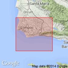
Type locality: north side of Canada Honda 3 mi east of Point Pedernales, Santa Barbara Co., southern CA.
Source: US geologic names lexicon (USGS Bull. 1200, p. 1795).
For more information, please contact Nancy Stamm, Geologic Names Committee Secretary.
Asterisk (*) indicates published by U.S. Geological Survey authors.
"No current usage" (†) implies that a name has been abandoned or has fallen into disuse. Former usage and, if known, replacement name given in parentheses ( ).
Slash (/) indicates name conflicts with nomenclatural guidelines (CSN, 1933; ACSN, 1961, 1970; NACSN, 1983, 2005, 2021). May be explained within brackets ([ ]).