The National Geologic Map Database is migrating to a new infrastructure. We apologize for any service disruptions during this process.
|
|---|


- Usage in publication:
-
- Honaker Trail formation
- Modifications:
-
- Named
- Dominant lithology:
-
- Limestone
- Sandstone
- Siltstone
- AAPG geologic province:
-
- San Juan Mountains province
- Black Mesa basin
- San Juan basin
Summary:
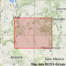
Named as the upper formation of the Hermosa group (raised in rank from formation) [but intent to change rank not stated] for Honaker Trail in sec 29, T41S, R18E, San Juan Canyon, San Juan Co, UT in San Juan Mountain province. Shown as extending into Black Mesa basin, AZ and northwest, San Juan basin, NM, but use of term Hermosa group in these two basins not clearly shown on figure 3. Replaces term "Upper Hermosa." Overlies Horn Point limestone [an unranked unit] of Hermosa. Underlies Rico facies. Consists of about 175 ft of gray to reddish gray, fine-crystalline to coarsely granular limestone with gray and red chert and reddish-gray to buff-gray calcareous sandy siltstones at Honaker Trail. Grades west and northwest into dolomite and becomes sandier basinward and toward Uncompahgre uplift. Ranges from 0 to 1,750 ft thick. Is correlative with upper third of Oquirrh formation of north-central UT, upper Madera limestone of central NM, lower to middle part of Supai formation of north-central AZ, and upper part of Gothic and lower part of Maroon formation of Eagle basin, CO. Is of late Cherokee, Marmaton, Missourian, and Virgilian age. Correlation charts. Cross sections.
Source: GNU records (USGS DDS-6; Denver GNULEX).
- Usage in publication:
-
- Honaker Trail Formation
- Modifications:
-
- Overview
- Revised
- AAPG geologic province:
-
- Paradox basin
Summary:
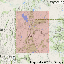
Revised in the Paradox basin in that the Pennsylvanian Honaker Trail Formation underlies marine carbonate rocks of the newly named Elephant Canyon Formation in the area that generally extends from the San Juan Mountains of CO west to the Four Corners area, CO-UT to the San Rafael Swell, UT in the Paradox basin. These carbonate rocks were part of the Rico formation of earlier reports. The author believes that the Honaker Trail Formation should be revised to include strata at the "type section" [of the Rico] in San Juan Canyon on the Monument upwarp, but unrelated carbonates to north would be excluded. [Author did not make a formal proposal in this report.] Correlation chart. Cross section.
Source: GNU records (USGS DDS-6; Denver GNULEX).
- Usage in publication:
-
- Honaker Trail Formation
- Modifications:
-
- Reference
- Revised
- AAPG geologic province:
-
- Paradox basin
- Black Mesa basin
- San Juan basin
Summary:
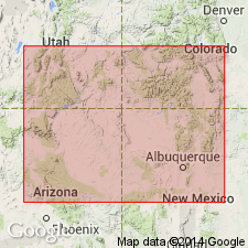
Alternate type section [reference section] designated at Raplee locality in secs 33, 34, T41S, R19E, San Juan Co, UT, where transition from evaporites of Paradox Formation to carbonates of Honaker Trail is observable (no evaporite is present at type). [No description at reference is provided; section was measured by Wengerd, Matheny (1958).] As originally defined by Wengerd, Matheny, Honaker Trail was overlain by Rico Formation. However, as Rico was abandoned by Baars (1962) authors revise Honaker Trail to include beds originally assigned to Rico. In this report, Honaker Trail includes all rocks between Paradox evaporites and Permo-Pennsylvanian disconformity at base of redbeds of Cutler Group in Four Corners and Monument upwarp and at base of Wolfcampian Elephant Canyon Formation in northwest Paradox basin and San Rafael swell regions within Paradox, Black Mesa, and San Juan basins. Assigned Missourian and Virgilian (Pennsylvanian) age.
Source: GNU records (USGS DDS-6; Denver GNULEX).
- Usage in publication:
-
- Honaker Trail Formation
- Modifications:
-
- Revised
- AAPG geologic province:
-
- Paradox basin
Summary:
Type section of Elephant Canyon Formation near confluence of Green and Colorado Rivers, San Juan Co, UT in the Paradox basin, restudied. Basal Elephant Canyon contact previously considered to be an angular unconformity that separated it from the underlying Honaker Trail Formation [upper formation of Hermosa Group]. Authors of this report traced individual beds in both formations and collected fossils (fusulinids) from both. They conclude: 1) there is no major break--no angular unconformity--within the sequence; 2) scour-surfaces are present in both formations; 3) the lower 450 ft of the original Elephant Canyon is Virgilian, not Wolfcampian, and thus no great time gap present between the Honaker Trail Formation of Missourian age and Wolfcampian rocks of the original upper Elephant Canyon. Fossils listed. Columnar sections. Name Elephant Canyon abandoned. Upper contact for upper member of Honaker Trail raised to top of a limestone 25+ ft thick about 560 ft above former top of Honaker Trail. Upper 590+ ft of former Elephant Canyon is reassigned as the informal "lower Cutler beds," rather than Rico Formation, because of distance between type Elephant Canyon and Rico. Cedar Mesa Sandstone overlies the "lower Cutler beds."
Source: GNU records (USGS DDS-6; Denver GNULEX).
- Usage in publication:
-
- Honaker Trail Formation*
- Modifications:
-
- Areal extent
- AAPG geologic province:
-
- San Juan basin
- Paradox basin
- Black Mesa basin
Summary:
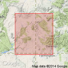
Isopach map shows eastern limit of Honaker Trail Formation (upper formation of Hermosa Group) in Rio Arriba Co., NM, its possible southern limit in Sandoval and McKinley Cos., NM in the San Juan basin. The formation thickens to the northwest to 1300 ft in vicinity of Durango, CO, Paradox basin. Thickens northward from 0 to 600 ft in northeast AZ, Black Mesa basin. Overlies Paradox Formation, middle formation of Hermosa. Underlies Rico Formation. Correlates with the lower upper part of Madera Limestone. Correlation chart. Pennsylvanian age.
Source: GNU records (USGS DDS-6; Denver GNULEX).
For more information, please contact Nancy Stamm, Geologic Names Committee Secretary.
Asterisk (*) indicates published by U.S. Geological Survey authors.
"No current usage" (†) implies that a name has been abandoned or has fallen into disuse. Former usage and, if known, replacement name given in parentheses ( ).
Slash (/) indicates name conflicts with nomenclatural guidelines (CSN, 1933; ACSN, 1961, 1970; NACSN, 1983, 2005, 2021). May be explained within brackets ([ ]).