

- Usage in publication:
-
- Homer limestone member
- Modifications:
-
- Named
- Dominant lithology:
-
- Limestone
- AAPG geologic province:
-
- Chautauqua platform
Summary:
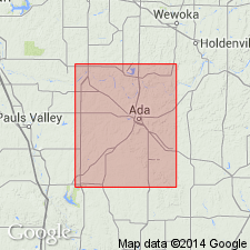
Named as lowermost of two members of Holdenville formation (revised in this report) for Homer School, Stonewall quad, Pontotoc Co, OK. No type locality designated. Occurs 70 ft below the Sasakwa limestone member of Holdenville (new). Best developed in northeast part of quad (Seminole and northern Pontotoc Cos, Chautauqua platform and Arkoma basin) where is about 3 ft thick. Shows a pronounced change from north to south; however, at foot of bluff, sec 25, T4N, R6E, shows a combination of the characteristics common to it in both north and south. In northeast part of quad, limestone is dark gray or nearly black; constitutes a reef of CHAETETES. Maintains reef-like character to south of Homer School, where quantity of CHAETETES diminishes and a few specimens of FUSILINA appear. To southwest CHAETETES disappears entirely and unit becomes a nearly pure FUSULINA limestone; color darkens to south. Bed is well exposed in stream valley just south of RR crossing in sec 10, T3N, R6E. West of here, can only be traced with certainty for less than 1 mi. There is an interval (varying in thickness) of Holdenville sandstone beds between Homer and overlying Sasakwa; one or several of these quite often develops into a massive chert conglomerate. Overlies Wewoka formation. Is of Pennsylvanian age. Fossil list for the Holdenville. Geologic map. Generalized columnar section.
Source: GNU records (USGS DDS-6; Denver GNULEX).
For more information, please contact Nancy Stamm, Geologic Names Committee Secretary.
Asterisk (*) indicates published by U.S. Geological Survey authors.
"No current usage" (†) implies that a name has been abandoned or has fallen into disuse. Former usage and, if known, replacement name given in parentheses ( ).
Slash (/) indicates name conflicts with nomenclatural guidelines (CSN, 1933; ACSN, 1961, 1970; NACSN, 1983, 2005, 2021). May be explained within brackets ([ ]).