


- Usage in publication:
-
- Holmesville shale member
- Modifications:
-
- Original reference
- Dominant lithology:
-
- Shale
- Limestone
- AAPG geologic province:
-
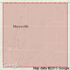
- Nemaha anticline
Summary:
Pg. 43. Holmesville shale. Basal member of Doyle formation of Chase group. Type locality 1.5 miles west and 0.5 mile north of Holmesville, Gage County, southeastern Nebraska, where it consists of (descending): (1) Gray, red and gray, argillaceous shale, 10 or 11 feet; (2) blocky limestone, 1 foot; (3) gray shale, 7 feet. The limestone persists for a considerable distance into Kansas. Thickness 20+/- feet in Nebraska, increasing to 35 feet in parts of Butler County, eastern Kansas. Underlies Towanda limestone member of Doyle and overlies Fort Riley limestone member of Barneston formation of Chase group. Age is Permian (Big Blue).
Source: US geologic names lexicon (USGS Bull. 896, p. 970-971); GNC KS-NE Permian Corr. Chart, Oct. 1936; supplemental information from GNU records (USGS DDS-6; Denver GNULEX).
- Usage in publication:
-
- Holmesville shale member
- Modifications:
-
- Areal extent
- AAPG geologic province:
-
- Nemaha anticline
Summary:
Pg. 42 (table 10), 53-55, pl. 1. Holmesville shale member of Doyle shale. In Marshall County, eastern Kansas, consists of about 20 feet of green, gray, and maroon calcareous shale; lenticular limestone beds about 1 foot thick present in lower few feet of member. Underlies Towanda member; overlies Fort Riley member of Barneston limestone. Age is Early Permian (Wolfcampian).
Source: US geologic names lexicon (USGS Bull. 1200, p. 1785).
For more information, please contact Nancy Stamm, Geologic Names Committee Secretary.
Asterisk (*) indicates published by U.S. Geological Survey authors.
"No current usage" (†) implies that a name has been abandoned or has fallen into disuse. Former usage and, if known, replacement name given in parentheses ( ).
Slash (/) indicates name conflicts with nomenclatural guidelines (CSN, 1933; ACSN, 1961, 1970; NACSN, 1983, 2005, 2021). May be explained within brackets ([ ]).