- Usage in publication:
-
- Hollycrest formation
- Modifications:
-
- Original reference
- Dominant lithology:
-
- Arkose
- Shale
- AAPG geologic province:
-
- Los Angeles basin
Summary:
Pg. 6 (table 1), 23-24, pl. 1. Hollycrest formation. Consists of thin-bedded, light-brown, medium- and fine-grained arkose and white to gray, silty clay shales. Composed of two unnamed members: a basal conglomerate and a sandstone, contact between the two is conformable and gradational; thin beds of conglomerate are present in lower 50 feet of the sandstone. Thickness about 1,700 feet. Underlies Modelo formation, but nature of contact uncertain, may or may not be a fault; unconformably overlies Topanga formation; locally overlies Cahuenga beds (new). Age is middle Miocene.
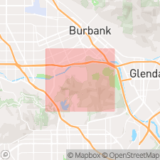
[Type locality not stated.] Occurs in Griffith Park area, city of Los Angeles, southern CA. Exposed in Griffith, Cahuenga Peak and Cahuenga Pass fault blocks. Name Hollycrest taken from highest point in Cahuenga Pass.
Source: US geologic names lexicon (USGS Bull. 1200, p. 1784).
For more information, please contact Nancy Stamm, Geologic Names Committee Secretary.
Asterisk (*) indicates published by U.S. Geological Survey authors.
"No current usage" (†) implies that a name has been abandoned or has fallen into disuse. Former usage and, if known, replacement name given in parentheses ( ).
Slash (/) indicates name conflicts with nomenclatural guidelines (CSN, 1933; ACSN, 1961, 1970; NACSN, 1983, 2005, 2021). May be explained within brackets ([ ]).

