The National Geologic Map Database is migrating to a new infrastructure. We apologize for any service disruptions during this process.
|
|---|


- Usage in publication:
-
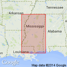
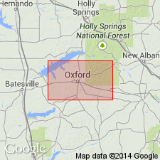
- Holly Springs sands
- Modifications:
-
- Original reference
- Dominant lithology:
-
- Sand
- AAPG geologic province:
-
- Upper Mississippi embayment
Summary:
Pg. 23-25. The middle division of Wilcox formation might appropriately be called Holly Springs sands. Thickness perhaps 350 feet. Is prevailingly sands, coarse-grained, cross-bedded, white to yellow, red, or purple; micaceous; becomes grayish or greenish beneath the surface. Typically developed at and for several miles east of Holly Springs [Marshall County, northeastern Mississippi]. Underlies Grenada beds and overlies Ackerman beds, the lowest division of the Wilcox.
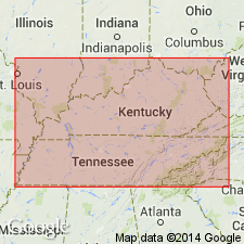
[GNC remark (ca. 1936, US geologic names lexicon, USGS Bull. 896, p. 970): In present usage of names the Wilcox is treated as a group and Holly Springs sand as middle formation of that group. Recognized in Mississippi and western Tennessee and Kentucky. Age is early Eocene.]
Source: US geologic names lexicon (USGS Bull. 896, p. 970).

- Usage in publication:
-
- "Holly Springs" sand
- Modifications:
-
- Areal extent
- AAPG geologic province:
-
- Upper Mississippi embayment
Summary:
Pg. 53. With the exception of Bashi and Hatchetigbee in Lauderdale County, Mississippi, surface Wilcox deposits of the State might well be called undifferentiated Wilcox. It may be true that general zones can be traced locally, but wisdom of giving formational rank to "Ackerman" and "Holly Springs" is questioned. Exposures of typical "Ackerman" are plentiful in area that is supposed to be underlain by "Holly Springs" sand, and many of the exposures of Holly Springs are probably Pleistocene terrace deposits.
Source: US geologic names lexicon (USGS Bull. 1200, p. 1784-1785).
- Usage in publication:
-
- Holly Springs†
- Modifications:
-
- Abandoned
- AAPG geologic province:
-
- Upper Mississippi embayment
Summary:
Pg. 17. Type Holly Springs of northern Mississippi, formerly included in Wilcox and correlated with Tuscahoma sand of Alabama, is nonmarine equivalent of Tallahatta formation to south. Name Holly Springs abandoned in favor of Tallahatta for all of Mississippi.
Source: US geologic names lexicon (USGS Bull. 1200, p. 1784-1785).
- Usage in publication:
-
- Holly Springs sand member*
- Modifications:
-
- Reinstated
- AAPG geologic province:
-
- Upper Mississippi embayment
Summary:
Correlation chart shows Holly Springs sand member of Tallahatta in Mississippi. Note states that nonmarine facies of Tallahatta formation in northern Mississippi was formerly called Holly Springs sand and placed in Wilcox group. For 1945 geologic map of Mississippi, Holly Springs was abandoned in favor of Tallahatta, but it should probably be retained for northern Mississippi, Tennessee, and Kentucky. Claiborne group. [Age is middle Eocene.]
Source: US geologic names lexicon (USGS Bull. 1200, p. 1784-1785).
- Usage in publication:
-
- Holly Springs formation
- Modifications:
-
- Not used
- AAPG geologic province:
-
- Upper Mississippi embayment
Summary:
Pg. 14, 20-21. Name Holly Springs should be dropped from literature inasmuch as sands included in formation are actually equivalents of three formations, the Meridian, Tallahatta, and Kosciusko. Discussion of Lafayette County.
Source: US geologic names lexicon (USGS Bull. 1200, p. 1784-1785).
- Usage in publication:
-
- Holly Springs formation
- Modifications:
-
- Areal extent
- AAPG geologic province:
-
- Upper Mississippi embayment
Summary:
Pg. 18 (fig. 1). A general section --embayment region of Tennessee and Kentucky-- shows Holly Springs formation below Grenada formation and above Ackerman formation in Tennessee. Wilcox group. Age is early Eocene.
Source: US geologic names lexicon (USGS Bull. 1200, p. 1784-1785).
- Usage in publication:
-
- Holly Springs Formation
- Modifications:
-
- Areal extent
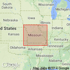
Anderson, K.H., 1979, Geologic Map of Missouri: Missouri Geological Survey
Summary:
Holly Springs Formation of Wilcox Group used on map. According to footnote, map contains stratigraphic names in current use as established by the Stratigraphy on Committee of the Missouri Geological Survey.
Source: GNU records (USGS DDS-6; Reston GNULEX).
- Usage in publication:
-
- Holly Springs Sand*
- Modifications:
-
- Revised
- Age modified
- AAPG geologic province:
-
- Upper Mississippi embayment
Summary:
Holly Springs Sand Member of Tallahatta Formation of Claiborne Group of MS, raised in rank to Holly Springs Sand for usage in MO. Age changed from middle Eocene to early and middle Eocene.
Source: GNU records (USGS DDS-6; Reston GNULEX).

- Usage in publication:
-
- Holly Springs Formation*
- Modifications:
-
- Age modified locally
- AAPG geologic province:
-
- Upper Mississippi embayment
Summary:
Wilcox Group in southeast MO was divided into (ascending) Ackerman Formation, Holly Springs Formation, and locally, the Idalia clay (informal) of the Holly Springs. More recently, has been divided into (ascending) Old Breastworks Formation, Fort Pillow Sand, and Flour Island Formation. Paleocene-Eocene boundary occurs in Flour Island Formation (Fredericksen and others, 1982). At first appearance, there seems to be close correlation between the two sets of nomenclature. However, from work in Jackson Purchase region of western KY, Olive (1980) describes occurrence of black chert pebbles as characteristic of Eocene Jackson Formation and Claiborne Group, but not of Wilcox Group. Black chert pebbles are common in Holly Springs Formation in MO. Thus, based on lithologic similarities, Holly Springs could be correlative with Jackson Formation and (or) Claiborne Group. This matter remains unresolved. Wilcox Group and Holly Springs Formation used in MO following usage of Missouri Geological Survey. Age of Wilcox is changed to Paleocene and Eocene(?) [and Holly Springs age changed to Eocene(?)] based on problems with correlation.
Source: GNU records (USGS DDS-6; Reston GNULEX).

- Usage in publication:
-
- Holly Springs Formation
- Modifications:
-
- Overview
Summary:
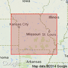
Pg. 7-8, 34, 134; Missouri Div. Geol. and Land Survey, v. 40 (revised), 2nd ser., 1995. Holly Springs Formation. Loosely-consolidated sandstone that varies in texture from fine- to coarse-grained and contains large quantities of sandy clay, clay, and gravel. Commonly cross-bedded and is variably sorted. Thickness varies from a few inches to 250+ feet. Underlies Mounds Gravel (formerly "Lafayette gravel") or alluvium. Overlies Ackerman Formation of Wilcox Group or, where absent, Porters Creek Clay. Difficult to distinguish from the Ackerman in subsurface. Includes †Bloomfield sands of Keyes (1894). Age is Eocene.
Typical development in Missouri in Benton Hills area, Scott Co., and on Crowley's Ridge, Stoddard Co.
Source: Publication.
For more information, please contact Nancy Stamm, Geologic Names Committee Secretary.
Asterisk (*) indicates published by U.S. Geological Survey authors.
"No current usage" (†) implies that a name has been abandoned or has fallen into disuse. Former usage and, if known, replacement name given in parentheses ( ).
Slash (/) indicates name conflicts with nomenclatural guidelines (CSN, 1933; ACSN, 1961, 1970; NACSN, 1983, 2005, 2021). May be explained within brackets ([ ]).