The National Geologic Map Database is migrating to a new infrastructure. We apologize for any service disruptions during this process.
|
|---|


- Usage in publication:
-
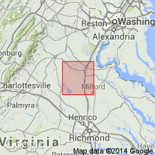
- Holly Corner Gneiss*
- Modifications:
-
- Named
- Dominant lithology:
-
- Gneiss
- AAPG geologic province:
-
- Piedmont-Blue Ridge province
Summary:
Named as part of Fredericksburg Complex. Named for crossroads of Holly Corner, Salem Church 7.5-min quad, Stafford Co., eastern VA. Present only in a refolded synform in Salem Church quad. Consists of dark-gray to black, fine- to medium-grained, well-foliated, hornblende- and biotite-rich gneiss. Sparse gray to pale-green calc-silicate layers are present in parts of the gneiss. Age is Early Cambrian based on correlation with Chopawamsic Formation, which is dated as Early Cambrian based on discordant zircon ages (Pavlides, 1976). Early Cambrian age is valid if the stratigraphic correlation is correct and zircon ages of Chopawamsic are real ages.
Source: GNU records (USGS DDS-6; Reston GNULEX).

- Usage in publication:
-
- Holly Corner Gneiss
- Modifications:
-
- Overview
- AAPG geologic province:
-
- Piedmont-Blue Ridge province
Summary:
Holly Corner Gneiss mapped near Stafford-Spotsylvania Co. border. Fredericksburg Complex not used on map nor mentioned in text. Holly Corner described as dark gray to black, fine- to medium-grained, strongly-foliated hornblende-biotite-rich gneiss. Predominant minerals includes hornblende, plagioclase, biotite, quartz and titanite. Accessories are zircon, epidote, microcline, chlorite. Age according to map symbol is Late Proterozoic and Cambrian.
Source: GNU records (USGS DDS-6; Reston GNULEX).
For more information, please contact Nancy Stamm, Geologic Names Committee Secretary.
Asterisk (*) indicates published by U.S. Geological Survey authors.
"No current usage" (†) implies that a name has been abandoned or has fallen into disuse. Former usage and, if known, replacement name given in parentheses ( ).
Slash (/) indicates name conflicts with nomenclatural guidelines (CSN, 1933; ACSN, 1961, 1970; NACSN, 1983, 2005, 2021). May be explained within brackets ([ ]).