

- Usage in publication:
-
- Hollis Dolomite Bed
- Modifications:
-
- First used
- Dominant lithology:
-
- Dolomite
- AAPG geologic province:
-
- Palo Duro basin
Summary:
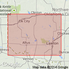
First published use as a bed in the Dog Creek Shale of El Reno Group. Was used earlier in a thesis by this author in 1967. Named for exposures south of town of Hollis in Harmon Co. Type section measured in bluff in SE1/4 SW1/4 NE1/4 sec 11, T1N, R26W to NE1/4 NE1/4 SE1/4 sec 1, T1N, R26W, Harmon Co, OK in the Palo Duro basin. Overlies red-brown and gray-green shale of Dog Creek. Underlies the informal Hollis gypsum or Hollis gypsum bed. [Two names should not be derived from the same geographic feature.] Consists of yellow-gray fossiliferous pelletoidal dolomite 2 ft thick at type. Cross sections. Permian age.
Source: GNU records (USGS DDS-6; Denver GNULEX).
For more information, please contact Nancy Stamm, Geologic Names Committee Secretary.
Asterisk (*) indicates published by U.S. Geological Survey authors.
"No current usage" (†) implies that a name has been abandoned or has fallen into disuse. Former usage and, if known, replacement name given in parentheses ( ).
Slash (/) indicates name conflicts with nomenclatural guidelines (CSN, 1933; ACSN, 1961, 1970; NACSN, 1983, 2005, 2021). May be explained within brackets ([ ]).