The National Geologic Map Database is migrating to a new infrastructure. We apologize for any service disruptions during this process.
|
|---|


- Usage in publication:
-
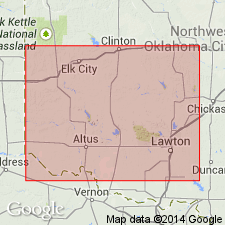
- Hollis gypsum
- Modifications:
-
- First used
- Dominant lithology:
-
- Gypsum
- AAPG geologic province:
-
- Palo Duro basin
Summary:
First published use as an informal bed in the Dog Creek Shale of El Reno Group. Named presumably for Hollis in Harmon Co, OK. No type locality designated. Was used earlier (1967) in a thesis by author. Overlies Hollis Dolomite Bed (first used) of Dog Creek. [Two names should not be derived from the same geographic locality.] Is an 8 ft thick white, finely crystalline gypsum in T1N, R26W, Harmon Co, OK in the Palo Duro basin. Ranges between 2-10 ft thick. Extends over a larger area than the Hollis Dolomite Bed. Underlies unnamed green-gray and red-brown shale of the Dog Creek. Permian age.
Source: GNU records (USGS DDS-6; Denver GNULEX).
For more information, please contact Nancy Stamm, Geologic Names Committee Secretary.
Asterisk (*) indicates published by U.S. Geological Survey authors.
"No current usage" (†) implies that a name has been abandoned or has fallen into disuse. Former usage and, if known, replacement name given in parentheses ( ).
Slash (/) indicates name conflicts with nomenclatural guidelines (CSN, 1933; ACSN, 1961, 1970; NACSN, 1983, 2005, 2021). May be explained within brackets ([ ]).