- Usage in publication:
-
- Hole-In-The-Wall member
- Modifications:
-
- Original reference
- Dominant lithology:
-
- Porphyry
- AAPG geologic province:
-
- Great Basin province
Summary:
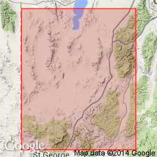
Pg. 90 (table 1), 92 (fig. 2), 99. Hole-In-The-Wall member of Isom formation. Upper member of formation at type locality; overlies Baldhills member (new). Latite porphyry, lithoidal in texture and purplish gray in color, with light-gray lenticules. Thickness seldom more than 40 feet. Exhibits some features of ignimbrites of highly welded type but also has internal structural features indicative of viscous flow. Discussion of ignimbrites of area. Age is Eocene(?) or early Oligocene(?).
Named for occurrence at east end of Hole-In-The-Wall Pass, 2 mi north of type locality of Isom formation, [Iron Springs district, Iron Co., southwestern UT].
Source: US geologic names lexicon (USGS Bull. 1200, p. 1781).
- Usage in publication:
-
- Hole-In-The-Wall Member
- Modifications:
-
- Areal extent
- AAPG geologic province:
-
- Great Basin province
Summary:
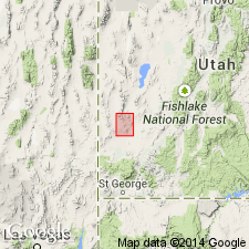
Hole-In-The-Wall Member of Quichapa Formation. Recognized in southern part of Wah Wah Mountains, southwestern Utah, where Quichapa Formation overlies erosion surface cut into member at Leighs Well. Assigned Tertiary age.
Source: GNU records (USGS DDS-6; Menlo GNULEX).
- Usage in publication:
-
- Hole-In-The-Wall Tuff Member*
- Modifications:
-
- Adopted
- AAPG geologic province:
-
- Great Basin province
Summary:
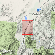
Hole-In-The-Wall Tuff Member of Isom Formation of Mackin (1960) is adopted by the USGS. Described as a sheet of purplish-gray lithoidal latite porphyry about 40 feet thick. Exhibits compaction foliation resembling that in Bauers Tuff Member of Quichapa Formation. [Age is Eocene or Oligocene. Notable exposures in secs. 7 and 18, T. 37 S., R. 12 W., Kanarraville 7.5-min quadrangle, Iron Co., southwestern UT.
Type locality: east end of Hole-In-The-Wall Pass, [in sec. 29], T. 34 S., R. 12 W., [Three Peaks 7.5-min quadrangle], Iron Springs district, Iron Co., southwestern UT. Named from Hole-In-The-Wall Pass, 2 mi north of Isom Creek (type locality of Isom Formation), Iron Springs district, Iron Co., southwestern UT.
[Misprint (USGS Bull. 1274-A, p. A9): should be early Oligocene or Eocene, not Oligocene or early Eocene.]
Source: Publication; Changes in stratigraphic nomenclature, 1967 (USGS Bull. 1274-A, p. A9); GNU records (USGS DDS-6; Menlo GNULEX).
- Usage in publication:
-
- Hole-In-The-Wall Member
- Modifications:
-
- Mapped
- Dominant lithology:
-
- Tuff
- AAPG geologic province:
-
- Great Basin province
- South Western Overthrust
Summary:
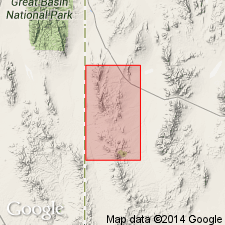
Hole-In-The-Wall Member of Isom Formation. Vitric to vitric-lithic phenoandesite tuff, 15 to 25 feet thick except southeast of Indian Peak where it is 70 feet thick. Overlies Baldhills Member of Isom Formation in southeast part of study near Indian Peak. Elsewhere overlies Needles Formation. Age is Oligocene.
Mapped in Needles Range, Beaver and Millard Counties, western Utah.
Source: Publication; GNU records (USGS DDS-6; Menlo GNULEX).
- Usage in publication:
-
- Hole-In-The-Wall Tuff Member*
- Modifications:
-
- Areal extent
- AAPG geologic province:
-
- Great Basin province
Summary:
Pg. B9, B10-B11 (fig. 2), B12; see also Anderson and Rowley, 1975, GSA Spec. Paper 160, p. 1-51. Hole-In-The-Wall Tuff Member of Isom Formation. Recognized in Utah and Nevada; notable exposures in Black Mountains. Is a pale-red, resistant vitric welded tuff; a single cooling unit. Usually less than 10 m thick. Lies below Narrows Tuff Member of Leach Canyon Formation of Quichapa Group and above Baldhills Tuff Member of Isom Formation. Age of Isom Formation is considered latest Oligocene or earliest Miocene, based on numerous K-Ar dates around 25 Ma (citing Armstrong, 1970, Geochemica et Cosmochimica Acta, v. 34; Fleck and others, 1975, GSA Spec. Paper 160, p. 53-62).
Source: Publication; GNU records (USGS DDS-6; Denver GNULEX).
- Usage in publication:
-
- Hole-In-The-Wall Tuff Member*
- Modifications:
-
- Age modified
- AAPG geologic province:
-
- Great Basin province
Summary:
Age of Isom Formation [and member] revised from Oligocene or Miocene to: Oligocene in Great Basin province based on herein adjusted radiometric age of 26 Ma (Fleck and others, 1975).
Source: GNU records (USGS DDS-6; Menlo GNULEX).
- Usage in publication:
-
- Hole-In-The-Wall Tuff Member*
- Modifications:
-
- Mapped 1:24k
- AAPG geologic province:
-
- Great Basin province
Summary:
Hole-In-The-Wall Tuff Member of Isom Formation. Resistant, medium-red, densely welded, crystal-poor, trachydacite ash-flow tuff. One simple cooling unit. Thickness about 50 m. Defined by Mackin (1960). Age is Oligocene.
Source: Publication.
- Usage in publication:
-
- Hole-In-The-Wall Tuff Member*
- Modifications:
-
- Areal extent
- AAPG geologic province:
-
- Great Basin province
Summary:
Hole-In-The-Wall Tuff Member of the Isom Formation is geographically extended into the southern Chief Range, Lincoln Co, NV. Age is Oligocene.
Source: GNU records (USGS DDS-6; Menlo GNULEX).
For more information, please contact Nancy Stamm, Geologic Names Committee Secretary.
Asterisk (*) indicates published by U.S. Geological Survey authors.
"No current usage" (†) implies that a name has been abandoned or has fallen into disuse. Former usage and, if known, replacement name given in parentheses ( ).
Slash (/) indicates name conflicts with nomenclatural guidelines (CSN, 1933; ACSN, 1961, 1970; NACSN, 1983, 2005, 2021). May be explained within brackets ([ ]).

