The National Geologic Map Database is migrating to a new infrastructure. We apologize for any service disruptions during this process.
|
|---|


- Usage in publication:
-
- Holder formation
- Modifications:
-
- Areal extent
- Dominant lithology:
-
- Limestone
- Shale
- Sandstone
- Conglomerate
- AAPG geologic province:
-
- Orogrande basin
Summary:
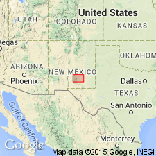
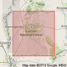
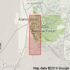
Pg. 93. Holder formation of Magdalena group. Appears only on composite columnar section, Sacramento Mountains, Otero County, southeastern New Mexico. Consists of limestone, gray and red calcareous shale, sandstone, and conglomerate. Bioherms at base locally. Thickness as much as 850 feet. Underlies Bm·sum formation; overlies newly named Beeman formation. [Age is Late Pennsylvanian (Virgilian).]
Source: US geologic names lexicon (USGS Bull. 1200, p. 1780).
- Usage in publication:
-
- Holder formation
- Modifications:
-
- First used
- Dominant lithology:
-
- Limestone
- Shale
- Sandstone
- Conglomerate
- AAPG geologic province:
-
- Orogrande basin
Summary:
First used as one of four formations of Magdalena group in the Sacramento Mountains. Type section is on Long Ridge, sec 15, T17S, R10E, Otero Co, NM in the Orogrande basin. Intent to name not stated. Overlies Beeman formation (first used) of Magdalena group. Holder-Beeman contact placed at base of discontinuous algal structures. Underlies Bursum formation, upper formation of Magdalena group. Has algal bioherms up to 100 ft thick that are concentrated in the lower 100 ft. Consists of gray limestone, red calcareous shale, sandstone. Conglomerate present at base locally. Is 0-850 ft thick. Cross sections, columnar sections, generalized geologic map. Of Late Pennsylvanian, Virgilian age.
Source: GNU records (USGS DDS-6; Denver GNULEX).
- Usage in publication:
-
- Holder formation
- Modifications:
-
- Overview
- AAPG geologic province:
-
- Orogrande basin
Summary:
Name Holder derived from Holder ridge in sec 36, T17S, R11E. Type section 65 ft thick (partial, top eroded) measured and described. Section is in Mule Canyon and Long Ridge area, NW1/4 NW1/4 sec 14 and NE1/4 NW1/4 and NW1/4 NE1/4 sec 15, T17S, R10E, Otero Co, NM in the Orogrande basin where Holder is stratigraphically above the Beeman formation. Though recognized as the upper formation of the Magdalena group, author states that the group name "serves little practical purpose." At type consists of red, gray to white limestone, red calcareous fossiliferous (fusulinids) shale, and one conglomerate bed of limestone pebbles and cobbles in a limy matrix. The limestone beds vary from thin-bedded to massive. Was intruded at type by an igneous sill. Columnar section, cross section. Is older stratigraphically than the Bursum or Abo formations. Is a shallow-shelf, marine deposit of Virgilian age. Occurs through the length of the mapped area (geologic map) forming a series of cliffs and ridges. Has been eroded from the east part of the mapped area. Can be as much as 900 ft thick. Algal bioherms and biostromal limestone 50-75 ft thick grown principally from the same horizon form massive cliffs. Calcareous green algae is the most abundant constituent of the bioherms. Is equivalent to the upper part, Panther Seep formation of the basin area to west.
Source: GNU records (USGS DDS-6; Denver GNULEX).
For more information, please contact Nancy Stamm, Geologic Names Committee Secretary.
Asterisk (*) indicates published by U.S. Geological Survey authors.
"No current usage" (†) implies that a name has been abandoned or has fallen into disuse. Former usage and, if known, replacement name given in parentheses ( ).
Slash (/) indicates name conflicts with nomenclatural guidelines (CSN, 1933; ACSN, 1961, 1970; NACSN, 1983, 2005, 2021). May be explained within brackets ([ ]).