The National Geologic Map Database is migrating to a new infrastructure. We apologize for any service disruptions during this process.
|
|---|


- Usage in publication:
-
- Holden group
- Modifications:
-
- Original reference
- Dominant lithology:
-
- Shale
- Limestone
- Sandstone
- AAPG geologic province:
-
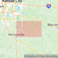
- Forest City basin
Summary:
Pg. 169, 194 [Chapter VI, Geological report on the country adjacent to the Pacific RR, from Sedalia to Kansas City, p. 157-216]. Holden group. Shales, limestones, and sandstones, 59 feet thick, including beds Nos. 55 to 64 of detailed section of lower Coal Measures from Sedalia to Kansas City. Underlies Mound group and overlies Lexington group. [Age is Pennsylvanian.]
Named from exposures at Holden, Johnson Co., northwestern MO.
Source: US geologic names lexicon (USGS Bull. 896, p. 968).

- Usage in publication:
-
- Holden group†
- Modifications:
-
- Abandoned
- AAPG geologic province:
-
- Forest City basin
Summary:
†Holden group. Is lower part of Pleasanton formation [= Desmoinesian Altamont Formation and Bandera Shale in Marmaton Group (ca. 2000).]
See also "Tentative correlation of the named geologic units of Missouri," compiled by M.G. Wilmarth, Secretary of Committee on Geologic Names, USGS unpub. corr. chart, Mar. 1930, sheet 1 [Devonian to Quaternary].
Source: US geologic names lexicon (USGS Bull. 896, p. 968); GNC MO Corr. Chart, sheet 1, Mar. 1930; Missouri lexicon (Thompson, 2001, Missouri Geol. Survey Rpt. Inv., no. 73, p. 9-10, 21-22).
For more information, please contact Nancy Stamm, Geologic Names Committee Secretary.
Asterisk (*) indicates published by U.S. Geological Survey authors.
"No current usage" (†) implies that a name has been abandoned or has fallen into disuse. Former usage and, if known, replacement name given in parentheses ( ).
Slash (/) indicates name conflicts with nomenclatural guidelines (CSN, 1933; ACSN, 1961, 1970; NACSN, 1983, 2005, 2021). May be explained within brackets ([ ]).