The National Geologic Map Database is migrating to a new infrastructure. We apologize for any service disruptions during this process.
|
|---|


- Usage in publication:
-
- Hogback Mountain Olivine Basalt
- Modifications:
-
- Named
- Dominant lithology:
-
- Basalt
- AAPG geologic province:
-
- Cascades province
Summary:
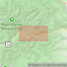
Crops out along ridge south of White Pass and on Hogback Mountain, Yakima Co, WA, in series of thin, highly vesicular flows. Vent is marked by volcanic neck 0.5 mi south of Hogback Mountain. Flows ponded in mi-wide crater 35 to 40 flows deep. Extends for 9 mi north and west of White Pass to position near junction of Lava Creek and Clear Fork River. Shown on geologic sketch map of White Pass region. Age given is Quaternary.
Source: GNU records (USGS DDS-6; Menlo GNULEX).
For more information, please contact Nancy Stamm, Geologic Names Committee Secretary.
Asterisk (*) indicates published by U.S. Geological Survey authors.
"No current usage" (†) implies that a name has been abandoned or has fallen into disuse. Former usage and, if known, replacement name given in parentheses ( ).
Slash (/) indicates name conflicts with nomenclatural guidelines (CSN, 1933; ACSN, 1961, 1970; NACSN, 1983, 2005, 2021). May be explained within brackets ([ ]).