- Usage in publication:
-
- Hoback formation
- Modifications:
-
- First used
- Dominant lithology:
-
- Sandstone
- Shale
- Limestone
- AAPG geologic province:
-
- Green River basin
Summary:
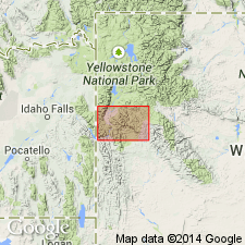
First published as a name applied to some gray sandstone and shale interbedded with limestone and conglomerate 5000+/-ft thick. Stratigraphic chart. Unconformably? overlies Frontier formation. Unconformably underlies Pass Peak conglomerate (first used). Freshwater fossil invertebrates found in the limestone. Fossil carnivore jaw of probable late Paleocene age identified. Of early Eocene? or Paleocene age. [Description taken from a stratigraphic chart for the section in the Teton, Snake River, and Gros Ventre ranges. The Teton Range is in Teton Co, WY in the Yellowstone province. The Snake River Range extends from Teton Co south into Lincoln Co. The Gros Ventre Range extends from Teton Co into Sublette Co. Lincoln and Sublette Cos are in the Greater Green River basin. However the areal extent of the Hoback is probably much more limited than the title of the stratigraphic chart implies. Hoback was first shown on a map by Eardley (1944)].
Source: GNU records (USGS DDS-6; Denver GNULEX).
- Usage in publication:
-
- Hoback formation
- Modifications:
-
- Principal reference
- Mapped
- Dominant lithology:
-
- Sandstone
- Shale
- AAPG geologic province:
-
- Green River basin
- Yellowstone province
Summary:
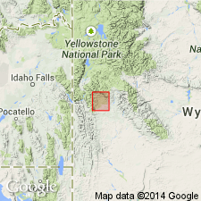
Pg. 64-71, pls. 1, 3, 4. Hoback formation. Described in detail. Bottom and top not exposed. Exposed part is a monotonous alternation of sandstone and shale with a few impure limestone beds and lenses of sub-bituminous coal. The sandstones consist mostly of quartz and lesser amounts of feldspar, mica, calcareous cement; are gray or brown, gray-weathering, fine- to coarse-grained, angular to subangular (suggesting local source), arkosic. Some sandstones are massive, others are thin, ripple marked, irregularly bedded. The shale is dark-gray to dark-brown, drab weathered. Thickness at type locality 1,885 feet. Known only in Hoback basin, Sublette and Teton Counties, Wyoming (pl. 1). Nonconformably underlies Pass Peak Conglomerate. Fossils; includes Dell Creek local fauna, [vertebrates described]. Age is tentatively early(?) Paleocene to early Eocene (late Puercan? to Wasatchian NALMA).
Type locality: exposures on southwestern side of Game Hill, opposite mouth of Cliff Creek, [in S/2 sec. 14], T. 38 N., R. 114 W., [southwestern corner Granite Falls 7.5-min quadrangle], Sublette Co., western WY. Good exposures along Hoback River, on northeast side of U.S. Highway 187 [U.S. 189/191], extending from Battle Mountain [northwest of type in adjacent Jackson 7.5-min quadrangle] southeastward for about 4 mi.
[Misprint (US geologic names lexicon, USGS Bull. 1200, p. 1772): type locality is on southwestern side of Game Hill, not southeastern side.]
Source: Publication; US geologic names lexicon (USGS Bull. 1200, p. 1772); GNU records (USGS DDS-6; Denver GNULEX).
- Usage in publication:
-
- Hoback(?) Formation*
- Modifications:
-
- Areal extent
- Age modified
- AAPG geologic province:
-
- Green River basin
Summary:
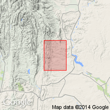
Hoback(?) Formation. Shown on cross sections of subsurface of Lincoln County, Wyoming (Greater Green River basin). Name provisionally applied to sequence above the Adaville Formation, and where Adaville is absent, above the Hilliard Shale. Consists of a drab mudstone, claystone, and siltstone cyclic sequence, with some sandstone, siltstone, and coal; thickness from about 2,500 to 3,000 feet. Can be more than 15,000 feet thick. Is older than Wasatch Formation. Age is considered late Paleocene, based on fossil pollen analyses of core. Name Fort Union Formation suggested as an alternative to name Hoback.
Source: Modified from GNU records (USGS DDS-6; Denver GNULEX).
- Usage in publication:
-
- Hoback Formation
- Modifications:
-
- Revised
- AAPG geologic province:
-
- Green River basin
- Yellowstone province
Summary:
Hoback Formation. Hoback restricted; either the upper 600 m or 2,600 m [?] of the Hoback is reallocated to Chappo Member of Wasatch Formation.
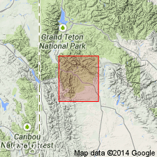
Divided into a main body and the newly named Skyline Trail Conglomerate Member. Mapped along east side of Hoback Range from vicinity of Hoback River, Sublette County, Wyoming (Greater Green River basin), north to Skyline Trail area in Teton County, Wyoming (Yellowstone province). Is about 2,000 m thick. Formerly considered to be about 4,600 m thick, but that thickness included rocks reassigned in this report to Chappo Member of Wasatch Formation. Skyline Trail is differentiated from the main body by these characteristics: (1) larger average clast size; (2) large clasts of soft, weakly cemented Cretaceous sandstone and red Triassic siltstone; (3) red color; (4) red clay and silt matrix; and (5) fine clastic strata of clay to sand size that are rare, thin, and of restricted lateral extent. Lower boundary of main body placed at base of a prominent conglomerate that rests on Harebell Formation. Upper contact of main body is conformable with basal yellow-tan sandstone of Chappo Member, or intertongued with the Skyline Trail. Age is middle Paleocene (Torrejonian) to earliest Eocene (Graybullian), based on fossil vertebrates and pollen. (geologic maps; fence diagram)
[Discrepancy in GNU records concerning thickness of rocks allocated to Chappo Member. --unresolved.]
Source: GNU records (USGS DDS-6; Denver GNULEX).
- Usage in publication:
-
- Hoback Formation*
- Modifications:
-
- Areal extent
- AAPG geologic province:
-
- Green River basin
Summary:
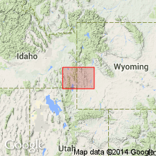
Hoback Formation. In northeastern part of Preston quadrangle, mapped in small area along Horse Creek, in T. 34 N., R. 114 and 115 W., Lincoln Co., WY (Greater Green River basin). Thickness is 4,500 m. Age is Paleocene. Is younger than Adaville Formation; is partly age-equivalent to and partly older than Wasatch Formation.
Source: Modified from GNU records (USGS DDS-6; Denver GNULEX).
For more information, please contact Nancy Stamm, Geologic Names Committee Secretary.
Asterisk (*) indicates published by U.S. Geological Survey authors.
"No current usage" (†) implies that a name has been abandoned or has fallen into disuse. Former usage and, if known, replacement name given in parentheses ( ).
Slash (/) indicates name conflicts with nomenclatural guidelines (CSN, 1933; ACSN, 1961, 1970; NACSN, 1983, 2005, 2021). May be explained within brackets ([ ]).

