

- Usage in publication:
-
- Hindsville limestone member*
- Modifications:
-
- Named
- Dominant lithology:
-
- Limestone
- Sandstone
Summary:
Hindsville limestone member of Batesville sandstone. Dark-gray limestone interbedded with some sandstone. Thickness 1.5 to 50 feet. In all previous reports on northern Arkansas has been included in underlying Boone limestone, but is here included in Batesville sandstone on paleontologic and lithologic grounds, and because of marked unconformity at its base. Age is Mississippian.
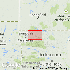
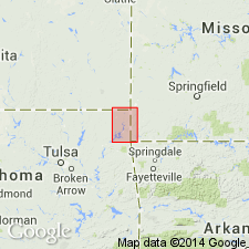
Named from exposure near Hindsville, Eureka Springs quadrangle, [Madison Co.], northern Arkansas.
Source: US geologic names lexicon (USGS Bull. 896, p. 961).
- Usage in publication:
-
- Hindsville formation
- Modifications:
-
- Contact revised
- Overview
- AAPG geologic province:
-
- Arkoma basin
- Chautauqua platform
Summary:
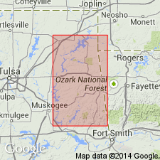
Lower contact revised in that Hindsville, the upper formation of the Mayes group (formerly Mayes formation) unconformably overlies the newly named Ordnance Plant Member, or an older member of the Moorefield formation. Moorefield is the lower formation of the Mayes. Hindsville mapped (5 geologic maps) over area from Craig, Mayes, Cherokee, Adair, Muskogee, and Sequoyah Cos., OK; these counties lie in the Arkoma basin and on the Chautauqua platform. Thickness variable --from 0 to 55 ft. Lithology variable in southern Mayes Co. Generally consists of gray, medium crystalline, thick-bedded, oolitic and fossiliferous limestone; has basal zone 6 inches thick of coquinite of crushed brachiopod fragments; elsewhere base is 2 to 3 ft of soft green calcareous shale and a main body of gray, oolitic limestone. Weathers to a soft, gray, crumbly, highly fossiliferous limestone. Grades upward into Fayetteville formation. Fauna is of early Chesterian, Late Mississippian age. Many measured sections.
Source: GNU records (USGS DDS-6; Denver GNULEX).
- Usage in publication:
-
- Hindsville Limestone*
- Modifications:
-
- Revised
- AAPG geologic province:
-
- Chautauqua platform
- Cherokee basin
Summary:
Revised in that Hindsville Limestone unconformably overlies the newly named Quapaw Limestone. In most places, conformably underlies the Batesville Sandstone. Area of this study is in the Picher field, a mining districts which straddles the OK-KS State line just a few miles west of the MO State line on the Chautauqua platform and Cherokee basin. Is 0-85+/-ft thick in the mining field where it consists of gray crinoidal to dense limestone, commonly oolitic, locally cherty; a little sandstone and green shale. Fossils (listed): mollusks, brachiopods, bryozoans, corals, echinoderms, trilobites, Isopach map; geologic map; cross section; stratigraphic table. Of Late Mississippian, Chester age.
Source: GNU records (USGS DDS-6; Denver GNULEX).
For more information, please contact Nancy Stamm, Geologic Names Committee Secretary.
Asterisk (*) indicates published by U.S. Geological Survey authors.
"No current usage" (†) implies that a name has been abandoned or has fallen into disuse. Former usage and, if known, replacement name given in parentheses ( ).
Slash (/) indicates name conflicts with nomenclatural guidelines (CSN, 1933; ACSN, 1961, 1970; NACSN, 1983, 2005, 2021). May be explained within brackets ([ ]).