

- Usage in publication:
-
- Hilt Bed*
- Modifications:
-
- Named
- Dominant lithology:
-
- Sandstone
- AAPG geologic province:
-
- Klamath Mountains province
Summary:
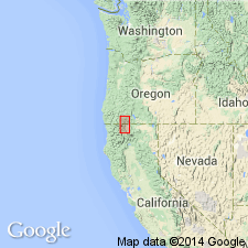
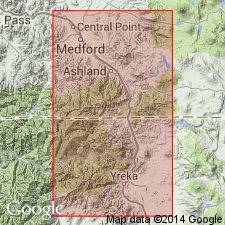
Is bed in Blue Gulch Mudstone Member of Hornbrook Formation. Named "Hilt bed" used informally by Nilsen (1983). Named for abandoned town of Hilt, located about 11 km northwest of Hornbrook, CA. Type section designated in road cut along access road to Hilt exit east of HWY I-5, NW/4 SW/4 sec.24 T48N R7W, Hornbrook 15' quad, Siskiyou Co, CA. Consists of mappable prominent beds of gray sandstone in middle part of Blue Gulch Member (new) of Hornbrook Formation. Is 4.71 m thick just south of Hilt. Crops out between northern margin of Shasta Valley and Dark Hollow area, northwest-southeast distance of about 50 km. No fossils reported from bed. Is probably Campanian(?) age.
Source: GNU records (USGS DDS-6; Menlo GNULEX).
- Usage in publication:
-
- Hilt Bed*
- Modifications:
-
- Age modified
- Reference
- Overview
- AAPG geologic province:
-
- Klamath Mountains province
Summary:
Reference section designated in SW/4 NW/4 sec.24 T48N R7W, Hornbrook 15' quad, Siskiyou Co, CA. Measured type section, detailed lithology, thickness, depositional environment and mapping included in study. Based on ages of foraminifers in underlying and overlying strata, age is "apparently late Campanian".
Source: GNU records (USGS DDS-6; Menlo GNULEX).
For more information, please contact Nancy Stamm, Geologic Names Committee Secretary.
Asterisk (*) indicates published by U.S. Geological Survey authors.
"No current usage" (†) implies that a name has been abandoned or has fallen into disuse. Former usage and, if known, replacement name given in parentheses ( ).
Slash (/) indicates name conflicts with nomenclatural guidelines (CSN, 1933; ACSN, 1961, 1970; NACSN, 1983, 2005, 2021). May be explained within brackets ([ ]).