The National Geologic Map Database is migrating to a new infrastructure. We apologize for any service disruptions during this process.
|
|---|


- Usage in publication:
-
- Hilltop formation
- Modifications:
-
- Named
- Dominant lithology:
-
- Shale
- Siltstone
- Sandstone
- AAPG geologic province:
-
- Chautauqua platform
- Arkoma basin
Summary:
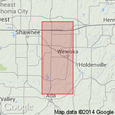
Named for Hilltop school in sec. 23, T 8 N, R 7 E, Seminole Co., OK on the Chautauqua platform where it is the upper formation (of 6) of the Missouri series. The school sits on the lower part of the formation. Type section measured in and near the Wewoka Brick and Tile Co. pit, north of Wewoka Creek in sec. 11, T 8 N, R 7 E. Name applied to beds above Belle City formation. Includes beds previously assigned to the Nellie Bly, Dewey, Chanute, Barnsdall, and Tallant formations, a sequence not divisible in Seminole Co. Consists of blue-gray shale that grades upward into massive buff siltstone and fine sandstone. Many thin limestones near base. Is 127 ft thick at type; basal 41 ft is blue shale with plant fossils, the overlying part is, in sequence, 1.) 22 ft of blue to green shale alternating with tan or buff siltstone and dense blue limestone, plant fossils at top, 2.) 7-20 ft of massive, tan to buff, siltstone or fine grained sandstone that has casts of brachiopods and pelecypods and is ripple marked, and 4.) 44 ft of shale at top. Unconformably overlain by Vamoosa formation. Fossils collected in Seminole Co. listed (brachiopods, pelecypods, gastropods, cephalopods, crinoids). Assigned to the Missouri, or lower part of the Upper Pennsylvanian. Also present in Pontotoc Co. to south in the Arkoma basin. Mapped (geologic map) the length of Seminole Co., east side of map. Ranges between 0 and 200 ft thick in report area.
Source: GNU records (USGS DDS-6; Denver GNULEX).
For more information, please contact Nancy Stamm, Geologic Names Committee Secretary.
Asterisk (*) indicates published by U.S. Geological Survey authors.
"No current usage" (†) implies that a name has been abandoned or has fallen into disuse. Former usage and, if known, replacement name given in parentheses ( ).
Slash (/) indicates name conflicts with nomenclatural guidelines (CSN, 1933; ACSN, 1961, 1970; NACSN, 1983, 2005, 2021). May be explained within brackets ([ ]).