

- Usage in publication:
-
- Hillside mica schist*
- Modifications:
-
- Named
- Dominant lithology:
-
- Schist
- Quartzite
- AAPG geologic province:
-
- Southwestern Basin-and-Range region
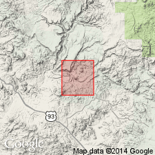
Summary:
Named for Hillside Mine [Mine not on geologic map base], along Boulder Creek, Bagdad area, Yavapai Co, AZ in the Southwestern Basin-and-Range region as youngest formation of Yavapai series. No type locality designated. Occurs extensively in south-central and southeast part of report area. Most complete section exposed along Boulder Creek. Has minimum thickness of 3,000 to 4,000 ft; upper limit not exposed. Includes muscovite schist, quartz-muscovite schist, and muscovite quartzite. In Butte Creek area basal part is dominantly muscovite schist that grades upward into alternating layers of muscovite schist, quartz-muscovite schist, and mica quartzite. Difficult to recognize order or sequence in other localities. Was originally shale, sandy shale, and impure sandstone that accumulated in a basin after a period of volcanic activity. Is cut by intrusive igneous rocks, particularly the Lawler Peak granite (new). Is younger than Butte Falls tuff (new) of Yavapai. Is older than King Peak rhyolite (new). Is pre-Cambrian. Geologic map.
Source: GNU records (USGS DDS-6; Denver GNULEX).
- Usage in publication:
-
- Hillside Mica Schist
- Modifications:
-
- Revised
- Not used
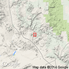
Summary:
Name not used. Rocks formerly called Hillside Mica Schist now mapped as part of a mixed [meta] volcanic sequence belonging to Butte Falls? Tuff and Hillside? Mica Schist that overlie Dick Rhyolite, Bagdad mining district, western Yavapai Co, AZ in Southwestern Basin-and-Range region. Geologic map provided extends coverage just south and west of map by Anderson, Scholz, and Strobell, Jr. (1955). Rocks formerly assigned to Hillside referred to as felsic tuffaceous and schistose rocks east of the Mountain Spring fault. Southward, similar rocks are mafic volcanics and lithology shows decrease in grain size. Could be younger than volcanic rocks of the Yavapai Series in the Jerome-Prescott area to the east. Is of Early Proterozoic age.
Source: GNU records (USGS DDS-6; Denver GNULEX).
For more information, please contact Nancy Stamm, Geologic Names Committee Secretary.
Asterisk (*) indicates published by U.S. Geological Survey authors.
"No current usage" (†) implies that a name has been abandoned or has fallen into disuse. Former usage and, if known, replacement name given in parentheses ( ).
Slash (/) indicates name conflicts with nomenclatural guidelines (CSN, 1933; ACSN, 1961, 1970; NACSN, 1983, 2005, 2021). May be explained within brackets ([ ]).