

- Usage in publication:
-
- Hillman tonalite
- Modifications:
-
- Named
- Dominant lithology:
-
- Tonalite
- AAPG geologic province:
-
- Lake Superior region
Summary:
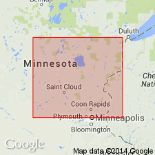
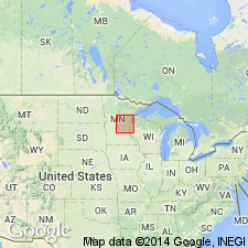
Name derived from exposures along Hillman Creek in vicinity of Skunk and Little Skunk Rivers and near Rum River, Morrison Co, central MN in Lake Superior region. Also known as Hillman gneissoid biotite tonalite. Inclusions and schlieren of Thomson formation are common, locally making up more than half the rock surface. Is one of five major intermediate intrusives of late Algoman age. Is mostly gray, foliated, medium granitoid and locally seriate. Generalized geologic map; petrographic description. Geologic succession shows younger Warman quartz monzonite (first used) and older St. Cloud gray granodiorite (named).
Source: GNU records (USGS DDS-6; Denver GNULEX).
- Usage in publication:
-
- Hillman Migmatite
- Modifications:
-
- Redescribed
- Reference
- Dominant lithology:
-
- Migmatite
- AAPG geologic province:
-
- Lake Superior region
Summary:
Present in eastern Morrison and northern Mille Lacs Cos, central MN in Lake Superior region. Rank term redescribed as migmatite because of variable proportions of igneous and metasedimentary material. Statement referring to "type locality" along Hillman Creek in SE1/4 sec 35, T41N, R29W wrongly attributed to Woyski (1949). Other reference sections occur along West Branch of Rum River in SE1/4 sec 9, T40N, R29W; Skunk River in SE1/4 sec 6, T41N, R28W; near center of sec 12, T41N, R29W; and in E1/2 sec 20 and W1/2 sec 21, T41N, R29W. Metasedimentary material dominantly dark-gray to black, fine- to medium-grained biotite schist and metagraywacke. May occur as separate or as interlayered masses often isoclinally folded about east-northeast-plunging axes. Is intruded by middle Precambrian igneous rocks and may represent part of early Precambrian basement upon which middle Precambrian strata were deposited. Petrologic description, generalized geologic map.
Source: GNU records (USGS DDS-6; Denver GNULEX).
For more information, please contact Nancy Stamm, Geologic Names Committee Secretary.
Asterisk (*) indicates published by U.S. Geological Survey authors.
"No current usage" (†) implies that a name has been abandoned or has fallen into disuse. Former usage and, if known, replacement name given in parentheses ( ).
Slash (/) indicates name conflicts with nomenclatural guidelines (CSN, 1933; ACSN, 1961, 1970; NACSN, 1983, 2005, 2021). May be explained within brackets ([ ]).