

- Usage in publication:
-
- Hillard Limestone*
- Modifications:
-
- Named
- Biostratigraphic dating
- Dominant lithology:
-
- Limestone
- Conglomerate
- AAPG geologic province:
-
- Alaska East-Central region
Summary:
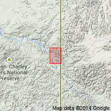
Named for exposures in vicinity of Hillard Peak. Composite type section designated on cliffs about 1.6 mi west of Hillard Peak, NE/4 sec.3 T1N R33E, on cliff about 1.3 mi north-northeast of peak, and section about 0.5 mi east-northeast of peak. Extends westward from Hillard Peak to Adams Peak area and northward to Tatonduk River and Montauk Bluff areas. Is resistant fossiliferous limestone characteristically fine-grained and pale-yellowish-brown. In Adams Peak-Yukon River area unit is predominantly edgewise conglomerate. Along Tatonduk River unit is dolomitic and weathers grayish orange. Ranges in thickness from 200 to about 500 ft. Overlies Adams Argillite (new). Unconformably underlies Road River Formation. Fossils indicate age ranges from Early Cambrian to Early Ordovician. At all but one locality formation is not younger than Late Cambrian.
Source: GNU records (USGS DDS-6; Menlo GNULEX).
For more information, please contact Nancy Stamm, Geologic Names Committee Secretary.
Asterisk (*) indicates published by U.S. Geological Survey authors.
"No current usage" (†) implies that a name has been abandoned or has fallen into disuse. Former usage and, if known, replacement name given in parentheses ( ).
Slash (/) indicates name conflicts with nomenclatural guidelines (CSN, 1933; ACSN, 1961, 1970; NACSN, 1983, 2005, 2021). May be explained within brackets ([ ]).