

- Usage in publication:
-
- Hillabee green schist belt
- Modifications:
-
- First used
- Dominant lithology:
-
- Schist
- AAPG geologic province:
-
- Piedmont-Blue Ridge province
Summary:
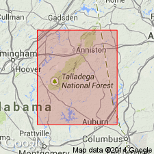
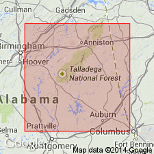
Name Hillabee green schist belt is introduced here for a belt of light-green, highly pyritiferous altered eruptive rock paralleling "Talladega" slate proper of Talladega Mountains on southeastern edge and apparently maintaining its continuity along the line of strike, from Coosa River, near mouth of Weogufka Creek, toward the northeast into Cleburne Co. This rock is distinguishable from "Talladega" slates by the large percentage of unaltered pyrites it carries, as well as by its massive structure, hardness, and toughness.
Source: GNU records (USGS DDS-6; Reston GNULEX).
- Usage in publication:
-
- Hillabee green schist
- Modifications:
-
- Named
- Dominant lithology:
-
- Schist
- AAPG geologic province:
-
- Piedmont-Blue Ridge province
Summary:
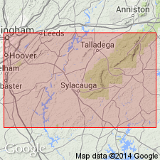
Hillabee, Iwana, or Millerville green schists are probably altered eruptive rock. They occur along southeastern border of the main mountain belt of Talladega slates in almost continuous outcrops. The names are those of localities where the rocks are exposed. The highly schistose and slaty varieties may be seen around Hillabee or Millerville, Clay Co. In places the Hillabee schists contain an abundance of pyrite in crystals disseminated through a siliceous rock. For present, therefore, the schists are grouped together under the name Hillabee, from the locality where they are typically exposed along Hillabee Creek.
Source: GNU records (USGS DDS-6; Reston GNULEX).

- Usage in publication:
-
- Hillabee chlorite schist
- Modifications:
-
- Revised
- AAPG geologic province:
-
- Piedmont-Blue Ridge province
Summary:
Hillabee chlorite schist is same as Hillabee green schist as mapped by E.A. Smith (1896). Unit is a metamorphosed basic intrusive, massive in places. Lies between Ashland mica schist and Talladega slate. Tentatively classified as post-Carboniferous(?).
Source: GNU records (USGS DDS-6; Reston GNULEX).
- Usage in publication:
-
- Hillabee Chlorite Schist
- Modifications:
-
- Overview
- AAPG geologic province:
-
- Piedmont-Blue Ridge province
Summary:
Hillabee Chlorite Schist is the easternmost of four rock units of Talladega belt. The Lay Dam Formation is the westernmost and grades into the Cheaha Quartzite. The Cheaha grades into the Abel Gap Formation, which grades eastward into the Hillabee. The Hillabee forms the major mafic stratigraphic horizon in the northern Alabama Piedmont. It consists predominantly of massive greenstone, chlorite schist, chlorite-sericite phyllite, cryptocrystalline quartz schist, meta-chert, and occasional thin, lenticular zones of graphitic quartz schist. The massive greenstone has been previously interpreted as a mafic dike, but recent investigations suggest that it may be a complex volcanic-clastic sequence, locally fault-bounded, but in normal stratigraphic position. The Hillabee grades eastward through a very steep metamorphic gradient into rocks of the Ashland-Wedowee belt.
Source: GNU records (USGS DDS-6; Reston GNULEX).
- Usage in publication:
-
- Hillabee Greenstone
- Modifications:
-
- Revised
- AAPG geologic province:
-
- Piedmont-Blue Ridge province
Summary:
Hillabee Greenstone, as unit is called in this report, is a mafic volcanic complex forming a broad valley in the Piedmont of northern AL. Unit is in fault contact with the Poe Bridge Mountain Group. Underlies rocks of the Ashland Supergroup and is interlayered with Jemison Chert. Overlies Chulafinnee Schist and Abel Gap Formation of Talladega Group. Bulk of evidence suggests an Early to Middle Devonian age, including 382+/-14 m.y. date from hornblende determined by G.S. Russell (1978 thesis).
Source: GNU records (USGS DDS-6; Reston GNULEX).

- Usage in publication:
-
- Hillabee greenstone*
- Modifications:
-
- Revised
- AAPG geologic province:
-
- Piedmont-Blue Ridge province
Summary:
The name Hillabee has been used since 1896 to describe a sequence of metavolcanic and metaplutonic rocks, variously modified by terms schist, chlorite schist, greenschist, or greenstone. The Hillabee resides in three separate thrust sheets of different origins and ages. Lower part belongs to the Paulding Volcanic-Plutonic Complex in the Paulding thrust sheet; upper part belongs to Ropes Creek Metabasalt in the Ropes Creek thrust sheet, which is locally underlain by the West Point melange. Should be considered informal. Age is mostly Cambrian.
Source: GNU records (USGS DDS-6; Reston GNULEX).

- Usage in publication:
-
- Hillabee Greenstone
- Modifications:
-
- Overview
- AAPG geologic province:
-
- Piedmont-Blue Ridge province
Summary:
Hillabee Greenstone, in the northern Piedmont, described as massive fine-grained pale-green to light-olive-brown greenstone, weathering to a dark-red or brownish-yellow and well-foliated, slaty mafic phyllites. Locally, reveals relict igneous textures. Felsic metavolcanic rocks (quartz dacites) are interlayered with the greenstones and mafic phyllites in areas where the thickness of the Hillabee exceeds 600 ft. Age is Paleozoic.
Source: GNU records (USGS DDS-6; Reston GNULEX).
- Usage in publication:
-
- Hillabee Greenstone
- Modifications:
-
- Age modified
- AAPG geologic province:
-
- Appalachian basin
Summary:
Unit is here interpreted as Early Devonian because of interbedded relationship with Butting Ram Formation and Jemison Chert. This conflicts with U-Pb zircon age of 458 Ma obtained by Russell (1978).
Source: GNU records (USGS DDS-6; Reston GNULEX).
For more information, please contact Nancy Stamm, Geologic Names Committee Secretary.
Asterisk (*) indicates published by U.S. Geological Survey authors.
"No current usage" (†) implies that a name has been abandoned or has fallen into disuse. Former usage and, if known, replacement name given in parentheses ( ).
Slash (/) indicates name conflicts with nomenclatural guidelines (CSN, 1933; ACSN, 1961, 1970; NACSN, 1983, 2005, 2021). May be explained within brackets ([ ]).