

- Usage in publication:
-
- Highland Peak [limestone]
- Modifications:
-
- Contact revised
- Dominant lithology:
-
- Limestone
- AAPG geologic province:
-
- Great Basin province
Summary:
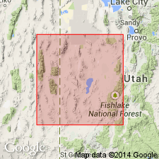
Lower contact revised in that Highland Peak [limestone] overlies the newly named Whirlwind formation in the Pioche district of Lincoln Co, NV in the Great Basin province. Diagrammatic cross section. Correlation chart. Assigned a Middle Cambrian age. Lower part belongs to BATHYURISCUS-ELRATHINA trilobite assemblage zone. Upper part belongs to the BOLASPIDELLA zone.
Source: GNU records (USGS DDS-6; Denver GNULEX).
- Usage in publication:
-
- Highland Peak Formation
- Modifications:
-
- Areal extent
- AAPG geologic province:
-
- Great Basin province
Summary:
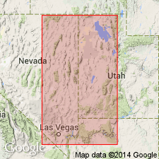
Shown on cross sections as present in eastern NV and western UT, Great Basin province, at Condor Canyon, Panaca, Striped Hills, and Bristol Range, NV and at Wah Wah Summit, UT. Is a thinly laminated carbonate, part of a regional occurrence of stromatolitic algal boundstones of Middle Cambrian and early Late Cambrian age. The boundstones form layers characterized by one or more types of algal stromatolites that are bounded by nonstromatolitic rocks. Detailed discussion of unit K of Highland Peak (which has been subdivided into units A through Q), its lithology and environment of deposition. Unit K thought to be a response to a pronounced marine regression. The event led to flooding of the continental shelf with terrigenous sands, and the emergence of islands flanked by supratidal zones.
Source: GNU records (USGS DDS-6; Denver GNULEX).
For more information, please contact Nancy Stamm, Geologic Names Committee Secretary.
Asterisk (*) indicates published by U.S. Geological Survey authors.
"No current usage" (†) implies that a name has been abandoned or has fallen into disuse. Former usage and, if known, replacement name given in parentheses ( ).
Slash (/) indicates name conflicts with nomenclatural guidelines (CSN, 1933; ACSN, 1961, 1970; NACSN, 1983, 2005, 2021). May be explained within brackets ([ ]).