- Usage in publication:
-
- High Falls Granite
- Modifications:
-
- Overview
- Dominant lithology:
-
- Granite
- AAPG geologic province:
-
- Lake Superior region
Summary:
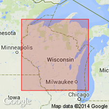
First published use as map unit in McCaslin syncline, western Marinette and northern Oconto Cos, WI (Lake Superior region). Name attributed to unpublished dissertation by Mancuso (Michigan State Univ.). Type locality not given, but implied to be named for High Falls, Marinette Co, WI. Noted to occur at field trip Stops 5 and 6. Is a reddish hornblende-rich granite that intrudes (or replaces) the Peshtigo River porphyry (first used) at Stop 5. At Stop 6 xenoliths of basalt and veins of aplite are noted. Age is not stated. Is shown on geologic sketch map (p. 3).
Source: GNU records (USGS DDS-6; Reston GNULEX).

- Usage in publication:
-
- High Falls Granite
- Modifications:
-
- Overview
- Geochronologic dating
- Dominant lithology:
-
- Granite
- AAPG geologic province:
-
- Lake Superior region
Summary:
Doubtfully included as part of the Wolf River batholith in central and northeastern WI in Lake Superior region. Generalized geologic map shows contacts with Belongia Granite, Peshtigo Monzonite (redescribed, revised), Hager Quartz Porphyry (redescribed), and Precambrian rocks older than 1,450-1,500 m.y. U-Pb concordia intercept age of about 1,500 m.y. is considered most reliable age estimate of the batholith. Is a heterogeneous unit, mainly medium-grained granite and quartz monzonite. Shear zones extensively developed in some outcrops; a feature absent from other units of the Wolf River batholith. Doubtful whether High Falls is truly part of the batholith; probably part of older, surrounding terrain. Included here with batholith because it intrudes McCaslin Quartzite and is spatially related to Hager Porphyry, Belongia Granite, and Peshtigo Monzonite (redescribed, revised). Age is Middle Proterozoic.
Source: GNU records (USGS DDS-6; Reston GNULEX).

- Usage in publication:
-
- High Falls Granite*
- Modifications:
-
- Overview
- AAPG geologic province:
-
- Wisconsin arch
Summary:
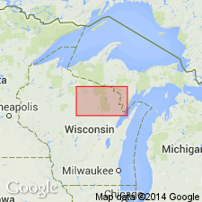
High Falls Granite. Dominantly gray when fresh, or pink when weathered, equigranular to porphyritic granite to granodiorite. Unit is irregularly shaped, with a northwest orientation, and locally contains numerous amphibolite inclusions. Intrudes Athelstane Quartz Monzonite, Peshtigo Mangerite, and Hager Formation. Excellent exposures seen locally along the Peshtigo River, between High Falls Reservoir and Caldron Falls Reservoir, in secs. 24, 25, and 36, T. 34 N., R. 17 E., and on rock knobs west of Eagle Creek, in secs. 32 and 33, T. 34 N., R. 18 E. Age is Middle Proterozoic.
Source: Modified from GNU records (USGS DDS-6; Reston GNULEX).
For more information, please contact Nancy Stamm, Geologic Names Committee Secretary.
Asterisk (*) indicates published by U.S. Geological Survey authors.
"No current usage" (†) implies that a name has been abandoned or has fallen into disuse. Former usage and, if known, replacement name given in parentheses ( ).
Slash (/) indicates name conflicts with nomenclatural guidelines (CSN, 1933; ACSN, 1961, 1970; NACSN, 1983, 2005, 2021). May be explained within brackets ([ ]).

