

- Usage in publication:
-
- Hess formation
- Modifications:
-
- First used
- Dominant lithology:
-
- Limestone
- Shale
- Conglomerate
- AAPG geologic province:
-
- Permian basin
Summary:
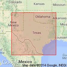
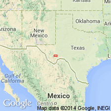
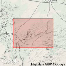
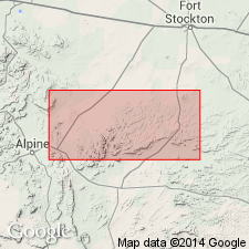
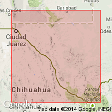
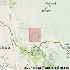
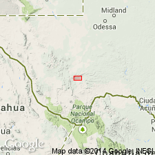
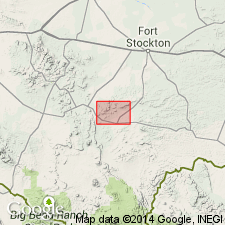
First use of name; intent to name not specifically stated, and no type locality designated. Found in the Glass Mountains, Brewster Co, TX in Permian basin. [Probably named for Hess ranch in the Glass Mountains.] Unconformably overlies Wolfcamp formation and unconformably underlies Leonard formation (both first used in this report). "This consists of a little more than 2,000 ft of limestones with some thin beds of shales and limestones and a well defined basal conglomerate. The bedding planes in this formation are regular and well marked and, excepting the basal part, it is free from coarse material. Most of its limestones are largely foraminiferal. The Hess forms the main south escarpment of the Glass Mountains from the Hess Ranch nearly to Gaptank." Is of Permian age. Geologic map [on which the Permian is shown undivided].
Source: GNU records (USGS DDS-6; Denver GNULEX).
- Usage in publication:
-
- Hess formation
- Modifications:
-
- Overview
- AAPG geologic province:
-
- Permian basin
Summary:
Forms main part of south face of ridge which extends from southernmost ridge east of Leonard Mountain and extends northeastward to Gaptank and from there northeast 3 mi along Marathon-Stockton Rd, Glass Mountains, Brewster Co, TX, Permian basin; is a continuous exposure of limestone. Quite distinct from other limestones in Glass Mountains; Hess limestones mostly thin bedded; but some are 5-10 ft thick. FUSULINA occurs in nearly all parts; also has other Foraminifera. Much of limestone oolitic; oolites very small. In upper part of unit, some encrustations of calcareous material seem to be rolled around organic fragments. Limestone is light gray; uniform development of beds. Generally resembles Hueco formation farther west, but fossil verification not made. Dolomitization of limestones unequal in different places; less dolomitized away from west end. Sandstones and shales present mostly in lower 400 ft; shales mostly bluish light gray, and sandstones usually free of limy material, open textured, moderately fine grained, cross bedded in places. 10- to 40-ft basal conglomerate consists mostly of limestone boulders; also has flint and other quartz boulders (underlying formations are source). Overlies Wolfcamp and Gaptank formation; underlies Leonard formation (which is distinguished by lack of well defined bedding planes). Brachiopods, ostracods and foraminifers. Fossil list. Permo-carboniferous. Geologic map, sections.
Source: GNU records (USGS DDS-6; Denver GNULEX).
- Usage in publication:
-
- Hess formation
- Modifications:
-
- Revised
- Overview
- AAPG geologic province:
-
- Permian basin
Summary:
Revised in Udden's (1917) "type section" [not actually so designated by Udden] in Leonard Mountain, Glass Mountains, Brewster Co, TX in Permian basin--lower half of Udden's Leonard formation "type section" here found to be Hess formation, a fact suspected by Udden. Hess is also present in lower part of Udden's Leonard sections farther west. Great lateral variation in thickness; thins to west across Glass Mountains, and may be divided into a western and an eastern facies, which intergrade near Hess ranch. Eastern facies consists of limestone, mostly thin bedded, dolomitic, and dark colored, abundant in fusulinids but barren of other fossils except in a few zones; interfingers eastward in lower part with vari-colored marls, sandstones and shales. Has a thin basal conglomerate. Western facies is massive, light-gray, non-dolomitic limestone. In easternmost sections near Pecos Co Line, 2,100 ft thick. Thins to west--not eroded. In Leonard Mountain section is 700 ft thick, the change in thickness being interpreted as a result of overlap on uplifted pre-existing rocks. Northeast of Lenox is only 50 ft thick. Base is in all places conglomeratic. Well-marked unconformity separates Hess from underlying Wolfcamp formation; conformably underlies Leonard formation (revised). Fossils common only in certain horizons and localities; most of formation unfossiliferous. Geologic map, sections. Of Permian age.
Source: GNU records (USGS DDS-6; Denver GNULEX).
- Usage in publication:
-
- Hess formation
- Modifications:
-
- Revised
- AAPG geologic province:
-
- Permian basin
Summary:
Pg. 57-69. Hess formation. Has not been well understood because of its great lateral variation in lithology and thickness. In his section on Leonard Mountain Udden provisionally placed in Leonard formation massive limestones regarded by us as Hess, though he recognized the possibility that the Hess might be present there. The type sections of the two formations therefore overlap. The contact is now placed at the natural line of subdivision between siliceous shales above and massive limestones below. In eastern part of Glass Mountains the Hess is a great mass of limestone, prevailingly thin-bedded and dolomitic, 2,130 feet thick. To the east the limestones are partly replaced by varicolored marls and shales. In western part of Glass Mountains the formation is less than 100 feet thick in places, and consists of massive light-gray pure limestone. Because of these differences the formation can be divided into an eastern and a western facies, with dividing line lying on Hess Ranch east of Leonard Mountain. Contact between Hess and Leonard formations is here interpreted as conformable, but many puzzling features remain to be explained. Contact is well exposed southwest from Leonard Mountain to Dugout Mountain, where the Leonard is 900 to 1,800 feet thick and the Hess only a few hundred feet thick. It is also well exposed northeast from Wood Ranch, where Leonard is 250 feet thick and Hess more than 2,000 feet thick. In neither area is there any evidence of erosion. Faunas of Hess and Leonard formations are similar, but there are certain characteristic elements in each not shared by the other, though both are of same facies. Although maximum thickness of each formation appears to be mutually inclusive of the other, the distinctive quality of the two faunas seems to argue against an intergradational relationship. The westward thinning of the Hess is result of an overlap on uplifted Wolfcamp beds and not the result of pre-Leonard erosion or the intergradation of Hess and Leonard facies.
[See also entry under Leonard.]
Source: US geologic names lexicon (USGS Bull. 896, p. 948).
- Usage in publication:
-
- Hess limestone member*
- Modifications:
-
- Revised
- AAPG geologic province:
-
- Permian basin
Summary:
Leonard formation revised--name here applied to all beds between the Wolfcamp formation (below) and the Word formation (above), with Hess formation reduced in rank and assigned as a limestone member of Leonard. Report area is Glass Mountains, Brewster Co, TX in Permian basin. Aggregate thickness of Leonard about 2,000 ft. To southwest the formation consists of interbedded siliceous shale (with Radiolaria), clay shale, and sandstone. Here occur many thin beds of limestone, which contain fossil fragments and pebbles of limestone and chert, probably derived from the erosion of the Marathon folds to the south. Basal part of formation consists of massive limestone, which thickens northeastward. Above there are 5 other members of massive limestone. In northeastern part of the mountains, the shaly beds occupy only a small thickness in upper part of formation. Beneath is a mass of thin-bedded, dirty gray dolomitic limestone with few fossils other than fusulinids. This is the Hess thin-bedded limestone member of the Leonard. Permian age. Correlation chart. Measured sections.
Source: GNU records (USGS DDS-6; Denver GNULEX).
- Usage in publication:
-
- Hess thin-bedded limestone member*
- Modifications:
-
- Areal extent
- AAPG geologic province:
-
- Permian basin
Summary:
Pg. 98. Hess thin-bedded limestone member of Leonard formation. Limestones northeast of Hess Ranch were named Hess formation in 1917 because they were thought to be separated by unconformity from Leonard beds above. Later work has shown that this unconformity does not exist, and evidence was presented (King, 1932, Amer. Jour. Sci., 5th ser., v. 34) which indicated that limestones of typical Hess formation were largely equivalent to shales and thin limestones typical of Leonard formation. The two facies were interpreted as being separated by limestone reefs. In present report, the two units are brought together in single formation, the Leonard, in accordance with Udden's original definition, and the Hess is designated as Hess thin-bedded limestone member.
Source: US geologic names lexicon (USGS Bull. 1200, p. 1747-1748).
- Usage in publication:
-
- Hess Formation*
- Modifications:
-
- Areal extent
- AAPG geologic province:
-
- Permian basin
Summary:
Areal extent of Hess Formation restricted to the eastern Glass Mountains of Brewster Co, TX in the Permian basin. Hess identified as far west as western Leonard Mountain. Beyond that mountain, Hess intertongues with the newly named Skinner Ranch Formation, and name Hess is thought by authors to have been assigned only to rocks of the lower member, the Decie Ranch Member (new) of the Skinner Ranch Formation of this report. Of Wolfcampian age. Cross section.
Source: GNU records (USGS DDS-6; Denver GNULEX).
- Usage in publication:
-
- Hess Formation*
- Modifications:
-
- Revised
- AAPG geologic province:
-
- Permian basin
Summary:
Hess Formation of the Glass Mountains, Brewster Co, TX in Permian basin revised in two ways. 1) First, it includes newly named Taylor Ranch Member. Taylor Ranch Member includes the "fossil bed" (King, 1931) and the conglomerate that typically occurs just below it; this distinctive member can be traced for many miles along mountain front. 2) Second, it is revised in the eastern Glass Mountains in that authors include upper part of Ross' (1963) Lenox Hills Formation (from about 1 mi east of Hess Ranch house eastward) in Hess Formation, and suggest that the top of Lenox Hills Formation in eastern Glass Mountains be drawn at the top of the highest bed of conglomerate or calcirudite. The lower part of the revised Hess Formation is of Wolfcamp age, equivalent to part of the Lenox Hills Formation of the western part of the Glass Mountains. Upper part has been shown by Ross (1960) to belong the Leonard Series, and authors' study of brachiopods corroborate his findings. Therefore, upper part of Hess is equivalent in age to Skinner Ranch Formation (revised) farther west in the mountains.
Source: GNU records (USGS DDS-6; Denver GNULEX).
- Usage in publication:
-
- Hess Formation
- Modifications:
-
- Revised
- AAPG geologic province:
-
- Permian basin
Summary:
Some conglomeratic rocks formerly assigned to the Hess Formation are reassigned to the newly named Stockton Gap Formation in the Gap Tank area, Pecos Co, TX, Permian basin. Geologic maps. Cross sections. Stratigraphic table. Called Hess Formation, Hess Thin-bedded Limestone Member of Leonard Formation, and Hess Conglomerate in this study.
Source: GNU records (USGS DDS-6; Denver GNULEX).
For more information, please contact Nancy Stamm, Geologic Names Committee Secretary.
Asterisk (*) indicates published by U.S. Geological Survey authors.
"No current usage" (†) implies that a name has been abandoned or has fallen into disuse. Former usage and, if known, replacement name given in parentheses ( ).
Slash (/) indicates name conflicts with nomenclatural guidelines (CSN, 1933; ACSN, 1961, 1970; NACSN, 1983, 2005, 2021). May be explained within brackets ([ ]).