

- Usage in publication:
-
- Hepburn's Mesa Formation
- Modifications:
-
- Named
- Dominant lithology:
-
- Claystone
- Siltstone
- Sandstone
- Conglomerate
- Tuff
- AAPG geologic province:
-
- Montana folded belt
Summary:
Pg. 1449-1453; fig. 3, 4, 5; table 1, 2. Hepburn's Mesa Formation. Consists of white, pink, and green silty claystone, clayey siltstone, very fine-grained sandstone, conglomerate and several tuff beds. Formation is exposed along east side of Yellowstone River, Montana; from approx. 25 km north of Gardiner to Emigrant Road Junction approx. 30 km farther north. Maximum exposed thickness is in type area, where it is 150+ m thick; outcrops to the north near Wanigan and to the south generally are <20 m thick. Is correlative with the Colter Formation of Jackson Hole, Wyoming. Age is middle Miocene; formation probably spans at least 16.0 Ma through 14.8 Ma. Basal part of formation is latest Hemingfordian or earliest Barstovian and upper part is late Barstovian (North American Land Mammal Ages), based on several hundred fossil-mammal specimens (insectivores, lagomorphs, rodents, artiodactyls, perissodactyls). Attempts to date the tuffs by K-Ar, Ar-Ar, and fission-track techniques have not been successful because tuffs are too fine-grained, highly zeolitized, and contain detrital zircon. Paleontologic and sedimentologic criteria suggest sediments represent mainly the dry mudflat and shallow perennial lake environments. The zeolite Clinoptilolite is present in 30 to 59 percent of samples; this mineral most commonly is indicative of moderately saline, alkaline lakes with a pH of 8.4 to 9.5 and a high ratio of Si/Al. The presence of gypsum and halite also indicate water was at least periodically saline. These rocks were formerly called lake beds, White Cliffs, and Chalk Cliffs. Report includes areal extent map, measured section, fossil mammals and minerals identified.
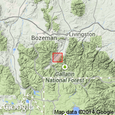
Type section: in NE/4 SE/4 sec. 23, T. 6 S., R. 7 E., Lat. 45 deg. 18 min. N., Long. 110 deg. 49 min. W., Park Co., MT. Named from exposures at Hepburn's Mesa, Park Co., MT (Montana folded belt province).
Source: Publication; GNU records (USGS DDS-6; Denver GNULEX).
For more information, please contact Nancy Stamm, Geologic Names Committee Secretary.
Asterisk (*) indicates published by U.S. Geological Survey authors.
"No current usage" (†) implies that a name has been abandoned or has fallen into disuse. Former usage and, if known, replacement name given in parentheses ( ).
Slash (/) indicates name conflicts with nomenclatural guidelines (CSN, 1933; ACSN, 1961, 1970; NACSN, 1983, 2005, 2021). May be explained within brackets ([ ]).