- Usage in publication:
-
- Henryhouse shale
- Modifications:
-
- Named
- Dominant lithology:
-
- Shale
- Limestone
- AAPG geologic province:
-
- South Oklahoma folded belt
Summary:
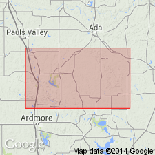
Named as a formation (1 of 4) of Hunton group; named from Henryhouse Creek, Carter Co, OK in the S. Oklahoma folded belt province. No type locality specifically designated. Occurs in the Arbuckle Mountains of south-central OK. Varies in thickness from 0-223 ft; averages 90 ft. Thickest exposures are in the Lawrence anticline on Chimneyhill creek in northeast corner of the Arbuckles and again in south limb of Arbuckle anticline along southwest border of mountains from Springer to Poolville; is not so thick in central part of mountains in vicinity of Dougherty; is "altogether wanting" on the eastern side of the Arbuckles from Canyon creek south to Bromide. Along Chimneyhill creek, consists of bluish to yellowish, thin to moderately thick bedded, earthy limestone and intercalated shale beds in lower 180 ft; upper 43 ft is white marly beds. In the "type area"[?] and in the vicinity of Dougherty, consists of alternating yellowish shales, shaly limestones, and bands of reddish earthy limestone. Unconformably overlies Chimneyhill limestone (new) and unconformably underlies Haragan shale (new), both of Hunton group. Fossil list includes listing in "Lower Henryhouse," "Upper Henryhouse," and a combination of the two; list of fossils represented includes anthozoans, crinoids, brachiopods, gastropods, crustaceans. Table of fossils in the Hunton group. Correlation table. Of Silurian age.
Source: GNU records (USGS DDS-6; Denver GNULEX).
For more information, please contact Nancy Stamm, Geologic Names Committee Secretary.
Asterisk (*) indicates published by U.S. Geological Survey authors.
"No current usage" (†) implies that a name has been abandoned or has fallen into disuse. Former usage and, if known, replacement name given in parentheses ( ).
Slash (/) indicates name conflicts with nomenclatural guidelines (CSN, 1933; ACSN, 1961, 1970; NACSN, 1983, 2005, 2021). May be explained within brackets ([ ]).

