The National Geologic Map Database is migrating to a new infrastructure. We apologize for any service disruptions during this process.
|
|---|


- Usage in publication:
-
- Henrieville Sandstone
- Modifications:
-
- Named
- Dominant lithology:
-
- Sandstone
- Siltstone
- Claystone
- AAPG geologic province:
-
- Paradox basin
Summary:
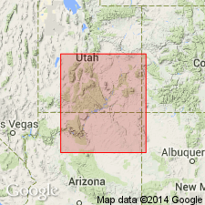
Named as a formation at top of San Rafael Group that lies between newly named Escalante Member of Entrada Sandstone and Dakota Sandstone. Both contacts are unconformable. Named for town of Henrieville, Garfield Co, UT in the Paradox basin. Type section measured on east side of Hwy 54, 1.5 mi north of town in sec 14, T37S, R2W. These rocks were mapped as Winsor Formation in earlier reports. Composed of, in sequence: l) green sandy siltstone and silty claystone (at base); 2) fine- to coarse-grained, cross-bedded, quartz sandstone that is very fine to medium grained, poorly sorted, calcareous; 3) green, sandy, laminated, calcareous shale; 4) very fine to coarse-grained, subangular to well rounded, frosted, cross-stratified, friable, ledgy sandstone; 5) fine-grained, poorly sorted sandstone of well-rounded subspherical quartz grains at type where it is 234 ft thick. Other measured sections. Occurs in steep cliffs around Henrieville. Ranges between 0 and 234 ft thick. Divisible into a lower member = to one-third the formation and an upper cross-bedded sandstone member. Calcite is the chief cementing agent. No fossils found. Definitely Late Jurassic age by stratigraphic position. May be lateral = of Salt Wash Member, Morrison Formation. Partly of fluvial and partly of eolian origin.
Source: GNU records (USGS DDS-6; Denver GNULEX).
- Usage in publication:
-
- Henrieville Sandstone
- Modifications:
-
- Not used
Summary:
The light-gray sandstone and mudstone assigned to the Henrieville Sandstone by Thompson and Stokes (1970) near Henrieville, Garfield Co, UT, Paradox basin, is considered to be the bleached zone of upper part of middle member and all of upper member of Entrada Sandstone of this report. Bleached zone, therefore, has no stratigraphic significance. Term Henrieville not recognized as a valid formation.
Source: GNU records (USGS DDS-6; Denver GNULEX).
For more information, please contact Nancy Stamm, Geologic Names Committee Secretary.
Asterisk (*) indicates published by U.S. Geological Survey authors.
"No current usage" (†) implies that a name has been abandoned or has fallen into disuse. Former usage and, if known, replacement name given in parentheses ( ).
Slash (/) indicates name conflicts with nomenclatural guidelines (CSN, 1933; ACSN, 1961, 1970; NACSN, 1983, 2005, 2021). May be explained within brackets ([ ]).