The National Geologic Map Database is migrating to a new infrastructure. We apologize for any service disruptions during this process.
|
|---|


- Usage in publication:
-
- Henrietta limestone
- Modifications:
-
- Original reference
- Dominant lithology:
-
- Limestone
- AAPG geologic province:
-
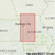
- Forest City basin
Summary:
Pg. 23-24, 25. Henrietta limestone. Several limestone beds separated by shales; 75 feet thick. Underlies Pleasanton shales and overlies Cherokee shales. Includes Mystic coal. Middle formation of Des Moines stage in Iowa, Missouri, and eastern Kansas. Includes Pawnee limestone member at top, Marmaton formation in middle, and Fort Scott limestone member at base in eastern Kansas.
Source: US geologic names lexicon (USGS Bull. 896, p. 941).
- Usage in publication:
-
- Henrietta formation*
- Modifications:
-
- Revised
Summary:
Henrietta formation as here defined is divided in Missouri into (descending) Pawnee limestone member, Labette shale member, and Fort Scott limestone member. The Lexington (Mystic) coal and the 6 feet of shale separating it from Fort Scott limestone are transferred to Cherokee shale. Thickness 26 to 110 feet. Age is Middle Pennsylvanian (Des Moines).
Source: US geologic names lexicon (USGS Bull. 896, p. 941); GNC KS-NE Pennsylvanian Corr. Chart, sheet 1, Oct. 1936.

- Usage in publication:
-
- Henrietta formation*
- Modifications:
-
- Overview
Summary:
Hinds and Greene's 1915 definition of Henrietta formation was followed generally until 1931, when R.C. Moore (Kansas Geol. Soc. 5th Ann. Field Conf. chart) dropped the name from the Kansas classification, treating its subdivisions as formations in his Okmulgee group (which he later replaced with Marmaton group and Cherokee group). The 1933 (57th Biennial) and 1935 (58th Biennial) reports of Missouri Bur. Geol. and Mines, however, continued to use Henrietta as defined by Hinds and Greene. Age is Middle Pennsylvanian (Des Moines).
Source: US geologic names lexicon (USGS Bull. 896, p. 941); GNC KS-NE Pennsylvanian Corr. Chart, 2 sheets, Oct. 1936.

- Usage in publication:
-
- Henrietta formation
- Modifications:
-
- Not used
Summary:
Pg. 57-58. At present time there seems to be little good reason to continue use of Henrietta. The Marmaton group includes Henrietta formation and lower part of Pleasanton shale [both of which he dropped from Kansas classification].
Source: US geologic names lexicon (USGS Bull. 896, p. 941); GNC KS-NE Pennsylvanian Corr. Chart, sheet 2, Oct. 1936.
- Usage in publication:
-
- Henrietta group
- Modifications:
-
- Revised
Summary:
Pg. 26-27 (fig. 2). Henrietta group. Columnar section shows group includes (ascending) Fort Scott limestone, Labette shale, Pawnee limestone, Bandera shale, Altamont limestone, and Nowata shale. Overlies Cherokee group; underlies Pleasanton group. Age is Middle Pennsylvanian (Des Moines).
Source: US geologic names lexicon (USGS Bull. 1200, p. 1734).
- Usage in publication:
-
- Henrietta group
- Modifications:
-
- Revised
Summary:
Pg. 95, 96. Henrietta group. A sandstone (Squirrel) commonly included in Cherokee group here included at base of Henrietta group in Fort Scott formation. Age is Middle Pennsylvanian (Des Moines).
Source: US geologic names lexicon (USGS Bull. 1200, p. 1734).

- Usage in publication:
-
- Henrietta group†
- Modifications:
-
- Abandoned
Summary:
Pg. 2027; F.C. Greene and W.V. Searight, 1949, Missouri Geol. Survey and Water Res. Rpt. Inv., no. 11, p. 5; G.E. Condra, 1949, Nebraska Geol. Survey Bull., no. 16, p. 43. †Henrietta group. Abandoned in favor of Marmaton group. [See Marmaton.]
Source: US geologic names lexicon (USGS Bull. 1200, p. 1734).
For more information, please contact Nancy Stamm, Geologic Names Committee Secretary.
Asterisk (*) indicates published by U.S. Geological Survey authors.
"No current usage" (†) implies that a name has been abandoned or has fallen into disuse. Former usage and, if known, replacement name given in parentheses ( ).
Slash (/) indicates name conflicts with nomenclatural guidelines (CSN, 1933; ACSN, 1961, 1970; NACSN, 1983, 2005, 2021). May be explained within brackets ([ ]).