

- Usage in publication:
-
- Hendry Ranch member*
- Modifications:
-
- Named
- Dominant lithology:
-
- Sandstone
- Siltstone
- Claystone
- AAPG geologic province:
-
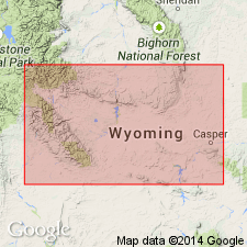
- Wind River basin
Summary:
Named as upper member of Tepee Trail formation for the Hendry Ranch in NE1/4 SE1/4 sec 14, T39N, R88W, Natrona Co, WY in the Wind River basin. Type section is in NE1/4 sec 31, T39N, R88W. Occurs (geologic map) north of Cedar Ridge fault and south of the Big Horn and Owl Creek Mountains in six areas. Has a maximum thickness of 550 ft. Overlies the green and brown member of the Tepee Trail. Its' top is erosional. Is the youngest mapped unit. Cross section; measured sections. Divisible. Lower part is a gray to gray-green, fine to very fine grained, soft, volcanic sandstone and volcanic siltstone that have some lenses of conglomerate and coarse-grained sandstone made up of pieces (as large as 1 ft in diameter) of pre-Cambrian and Cambrian rocks. Upper part consists of tan, volcanic, limy, poorly bedded siltstone and in upper part some gray to black, waxy thin beds of claystone; is about 350 ft thick. The volcanic component is andesite. Local nodular zones are fossiliferous. Forms badlands and slopes. Yielded a fauna (listed) of late Eocene age. Fauna includes snails, larval chambers of insects, vertebrates.
Source: GNU records (USGS DDS-6; Denver GNULEX).
For more information, please contact Nancy Stamm, Geologic Names Committee Secretary.
Asterisk (*) indicates published by U.S. Geological Survey authors.
"No current usage" (†) implies that a name has been abandoned or has fallen into disuse. Former usage and, if known, replacement name given in parentheses ( ).
Slash (/) indicates name conflicts with nomenclatural guidelines (CSN, 1933; ACSN, 1961, 1970; NACSN, 1983, 2005, 2021). May be explained within brackets ([ ]).