The National Geologic Map Database is migrating to a new infrastructure. We apologize for any service disruptions during this process.
|
|---|


- Usage in publication:
-
- Hely member
- Modifications:
-
- Original reference
- AAPG geologic province:
-
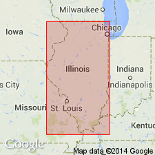
- Wisconsin arch
Summary:
Fig. 3. Hely member of Grand Detour formation. Shown on columnar section as underlying Victory member (new) and overlying Clement member (new) [of Grand Detour formation]. Age is Middle Ordovician.
[Notable exposures in Dixon-Oregon area, northern IL.]
Source: US geologic names lexicon (USGS Bull. 1200, p. 1729).
- Usage in publication:
-
- Hely Member
- Modifications:
-
- Overview
- AAPG geologic province:
-
- Wisconsin arch
Summary:
Pg. 129. Hely Member of Hager Limestone of Plattin Group. Thompson (1995, Missouri Dept. Nat. Res., Div. Geol. and Land Survey, 2nd ser., v. 40 revised, p. 34) stated "The Hely Member of the Hager Limestone is a thinner, dark-gray, burrowed limestone between the massive unburrowed, light-gray to white Victory and Glaize Creek Members. Its appearance is more like that of "typical" Plattin. If the Glaize Creek Member is not present, as along I-44, the Hely cannot be separated from the underlying Beckett." Age is Ordovician (Mohawkian).
Type section: Templeton and Willman (1963, Illinois Geol. Survey Bull., no. 89, p. 86) stated "The Hely Member ... is here named for Hely's upper quarry, which, with the adjoining Federal and Marquette quarries, constitutes the type section, at the southern outskirts of Cape Girardeau, Missouri..."
Source: Publication.
For more information, please contact Nancy Stamm, Geologic Names Committee Secretary.
Asterisk (*) indicates published by U.S. Geological Survey authors.
"No current usage" (†) implies that a name has been abandoned or has fallen into disuse. Former usage and, if known, replacement name given in parentheses ( ).
Slash (/) indicates name conflicts with nomenclatural guidelines (CSN, 1933; ACSN, 1961, 1970; NACSN, 1983, 2005, 2021). May be explained within brackets ([ ]).