

- Usage in publication:
-
- Helms group
- Modifications:
-
- Original reference
- Dominant lithology:
-
- Sandstone
- Limestone
- Shale
- AAPG geologic province:
-
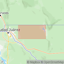
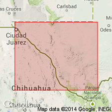
- Orogrande basin
Summary:
Pgs. 8, 30, 36, geologic map. Helms group (Mississippian). Yellowish thin-bedded rocks. Local facies vary somewhat from place to place, but main features are almost always present. Locally there are thin sandstones in top of Helms group. To north of Long Canyon nearly the whole series is made up of platy drab to dark-buff limestones (which as a rule weather buff), with, locally, considerable chert in concretions, masses, and layers, and some sandstone, all separated by thin layers of marl that weathers buff. Below is a covered slope largely composed of clay shale. Fossils in most beds, but rare except locally in uppermost part of section. According to S. Weller is of Chester age. Thickness of formation 400 to 600 feet. [Gives a detailed section 1+/- mile south of Helms Peak, Hueco Mountains, western Texas.] Unconformably underlies Magdalena group (Pennsylvanian). [Originally included in Hueco limestone.]
[Type section]: measured section C, in short canyon [now Martin Canyon] about 1 mi south of Helms Peak, and about 2.5 mi north of Helms West Well, [in vicinity of Lat. 31 deg. 48 min. 15 sec. N., Long. 106 deg. 01 min. 20 sec. W., Helms West Well 7.5-min quadrangle], Hueco Mountains, El Paso Co., western TX.
Probably named from Helms Peak, elevation 5,392 ft, [approx. Lat. 31 deg. 49 min. 15 sec. N., Long. 106 deg. 01 min. 35 deg. W., El Paso quadrangle, scale 1:125,000, ca. 1920 and earlier editions], Hueco Mountains, El Paso Co., western TX.
[Additional locality information from USGS GNIS database and USGS historical topographic map collection TopoView, accessed on September 10, 2023,]
Source: US geologic names lexicon (USGS Bull. 896, p. 939).
- Usage in publication:
-
- Helms group
- Modifications:
-
- Revised
- AAPG geologic province:
-
- Orogrande basin
Summary:
Pg. 909. Helms group. 400 to 700 feet thick, includes beds of Chester, [early] Mississippian, and [Late] Devonian age.
Source: US geologic names lexicon (USGS Bull. 896, p. 939).

- Usage in publication:
-
- Helms formation*
- Modifications:
-
- Adopted
- AAPG geologic province:
-
- Orogrande basin*
Summary:
Helms formation. Adopted by the USGS. Age is considered Mississippian and Devonian(?). The upper 500 feet of Helms formation of Hueco Mountains, western Texas, contains a Chester fauna (G.H. Girty, USGS, unpublished report); the remainder of the formation is unfossiliferous.
Source: US geologic names lexicon (USGS Bull. 896, p. 939).
- Usage in publication:
-
- Helms formation
- Modifications:
-
- Revised
- Areal extent
- AAPG geologic province:
-
- Orogrande basin
Summary:
Pgs. 8-9, 16-17, 19-20, 23, 32, 35, 39. Helms formation. Beede designated all rocks between Silurian and Pennsylvanian systems in Hueco Mountains as Helms. Name here restricted to upper part of these strata. As thus restricted, consists of green shale, shaly sandstone, and impure limestone beds, containing Chester fossils. In type area (sec. 7, Blk. 9, El Paso County, western Texas), unconformably overlies Rancheria formation (new) and unconformably underlies Pennsylvanian rocks. Thickness 98 feet in Franklin Mountains, Dona Ana County, southeastern New Mexico. Age is Mississippian.
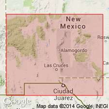
Recognized in Hueco Mountains (Otero Co., NM, and El Paso Co., TX) and Franklin Mountains (Dona Ana Co., NM).
Source: US geologic names lexicon (USGS Bull. 1200, p. 1729).
For more information, please contact Nancy Stamm, Geologic Names Committee Secretary.
Asterisk (*) indicates published by U.S. Geological Survey authors.
"No current usage" (†) implies that a name has been abandoned or has fallen into disuse. Former usage and, if known, replacement name given in parentheses ( ).
Slash (/) indicates name conflicts with nomenclatural guidelines (CSN, 1933; ACSN, 1961, 1970; NACSN, 1983, 2005, 2021). May be explained within brackets ([ ]).