

- Usage in publication:
-
- Hells Half Acre Tuff Member*
- Modifications:
-
- Named
- Dominant lithology:
-
- Tuff
- AAPG geologic province:
-
- Basin-and-Range province
Summary:
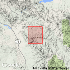
Named as a member of the Galiuro Volcanics for exposures on Hell's Half Acre in sec 19, T6S, R18E, Pinal Co, AZ in the Basin-and-Range province. Type locality is in Aravaipa Canyon upstream from Javelina Canyon, sec 7, T6S, R18E. Divisible into (ascending): 1) 0-50 ft thick well-bedded, cliff-forming, porous, yellow-brown to brown, finely crystalline rhyolite tuff with pumice lapilli, grains of quartz, feldspar, and biotite; 2) 0-400 ft thick massive, cliff-forming, white vitric tuff, perhaps one or more nonwelded to slightly welded ash-flow tuffs, composed of white to yellow-brown pumice lapilli, some obsidian and rhyolite lapilli, and quartz, feldspar, and minor biotite grains; 3) 0-100+ ft thick cliff- and slope-forming, white, air-fall and partly reworked vitric lithic and crystal tuff. Pumice lapilli and groundmass have been extensively zeolitized. Overlies rhyolite-obsidian member; underlies Apsey Conglomerate Member (new), both of the Galiuro. Occurs in northeast, northwest, southeast, and at scattered localities in north-central part of quad. Miocene age.
Source: GNU records (USGS DDS-6; Denver GNULEX).
- Usage in publication:
-
- Hells Half Acre Tuff Member*
- Modifications:
-
- Geochronologic dating
- AAPG geologic province:
-
- Basin-and-Range province
Summary:
As a member of Galiuro Volcanics, has isotopic ages of 22.5 +/-0.7 m.y. on sanidine and 24.6 +/-0.7 m.y. on biotite, or Miocene and late Oligocene. Occurs in the northern Galiuro Mountains, AZ, Basin-and-Range province. Geologic map; correlation chart.
Source: GNU records (USGS DDS-6; Denver GNULEX).

- Usage in publication:
-
- Hells Half Acre Tuff Member*
- Modifications:
-
- Age modified
- AAPG geologic province:
-
- Basin-and-Range province
Summary:
Age of the Hells Half Acre Tuff Member of the Galiuro Volcanics is revised from Miocene to late Oligocene or early Miocene based on isotopic (K-Ar) ages of 24.6 +/-0.7 Ma (biotite) and 22.5 +/-0.7 Ma (sanidine).
Source: GNU records (USGS DDS-6; Menlo GNULEX).
For more information, please contact Nancy Stamm, Geologic Names Committee Secretary.
Asterisk (*) indicates published by U.S. Geological Survey authors.
"No current usage" (†) implies that a name has been abandoned or has fallen into disuse. Former usage and, if known, replacement name given in parentheses ( ).
Slash (/) indicates name conflicts with nomenclatural guidelines (CSN, 1933; ACSN, 1961, 1970; NACSN, 1983, 2005, 2021). May be explained within brackets ([ ]).