

- Usage in publication:
-
- Hells Canyon formation
- Modifications:
-
- Named
- Dominant lithology:
-
- Conglomerate
- Limestone
- Shale
- Sandstone
- AAPG geologic province:
-
- Green River basin
Summary:
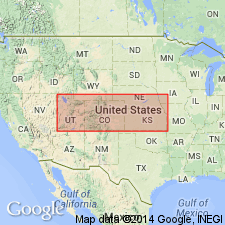
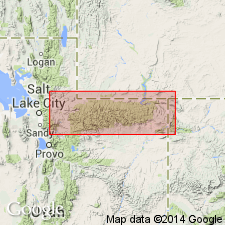
Named for rocks at the type locality in Hell's Canyon, west bluff of canyon in sec 31, T6N, R102W, tributary canyon of the Yampa River in Moffat Co, CO in the Greater Green River basin. Is composed of gray fossiliferous limestone, gray shale, red shale, purple siltstone, thin beds of gray and red fine-grained sandstone. Lower 10 ft at type is a coarse conglomerate of limestone and chert pebbles, and yellow to red coarse quartz sand. The overlying 125 ft is purple shale interbedded argillaceous limestone, purple siltstone; fossil fusulinids abundant. Upper 159 ft are highly fossiliferous cherty limestone, fossiliferous shale thin beds of red shale, and gray to purple fine-grained sandstone; fusulinids abundant in upper part. Present throughout most of canyon of Yampa River at Juniper Mountain. Is 165 ft thick at Juniper Mountain. Two graphic sections show lithology and location of fossils. Probably replaced by Morgan Formation at Split Mountain. Overlies Belden formation; underlies Youghall formation (new). Pennsylvanian age. Belongs to uppermost part of Zone of FUSULINELLA. Names such as Morgan formation have been applied to these rocks in earlier reports. Fossils include brachiopods, algae, crinoid fragments, corals, forams. Measured sections.
Source: GNU records (USGS DDS-6; Denver GNULEX).
- Usage in publication:
-
- Hells Canyon formation
- Modifications:
-
- Revised
- AAPG geologic province:
-
- Uinta basin
- Uinta uplift
- Green River basin
Summary:
Assigned as the basal formation of the newly named Durst group. Although the Durst group is known to extend as far west as Morgan Co, UT, the author suggests that the Hells Canyon might be limited to the southeast flank of the Uinta Mountains, Uinta uplift, under the Uinta basin, and Moffat Co, CO, Greater Green River basin. No Hells Canyon is present in T1N, R8W, Duchesne Co. May pinch out into Morgan formation. Unconformably overlies Round Valley formation. Underlies Morgan formation of Durst group. Correlation chart. Cross section. Of Des Moines, Pennsylvanian age.
Source: GNU records (USGS DDS-6; Denver GNULEX).
For more information, please contact Nancy Stamm, Geologic Names Committee Secretary.
Asterisk (*) indicates published by U.S. Geological Survey authors.
"No current usage" (†) implies that a name has been abandoned or has fallen into disuse. Former usage and, if known, replacement name given in parentheses ( ).
Slash (/) indicates name conflicts with nomenclatural guidelines (CSN, 1933; ACSN, 1961, 1970; NACSN, 1983, 2005, 2021). May be explained within brackets ([ ]).