- Usage in publication:
-
- Hell Hole Conglomerate*
- Modifications:
-
- Named
- Dominant lithology:
-
- Conglomerate
- AAPG geologic province:
-
- Basin-and-Range province
Summary:
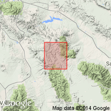
Named for the Hell Hole in the lower reaches of Old Deer Creek, T6S, Rs18 and 19E, Pinal and Graham Cos, AZ, Basin-and-Range province. No type locality designated. Is exposed along a broad belt along the east flank of the Galiuro Mountains. A few small outcrops on southwest slope of Santa Teresa Mountains. Covers about 50 sq mi in quad. Is at least 400 ft thick at type [at Hell Hole?]. Thickness is not known, but may be as much as 2,000 ft. Is in general a light colored cream, orange, pink, brown, or gray, moderately to well-indurated rock composed of pebbles, cobbles, and occasional boulders of volcanic rock in a sand or grit matrix. Most of the volcanic fragments probably came from Galiuro Mountains. Sorting ranges from good to poor, typical of fluviatile deposits rather than mudflows. Coarse components are angular to subangular. Some fine-grained white ash. Lens of impure limestone and cherty limestone 3 to 4 ft thick noted that had ostracodes and rhizopods. No fossils found elsewhere in Hells Hole. Unconformably overlies the Galiuro and Horse Mountain Volcanics. Is overlain by alluvium. Is assigned a middle or late Tertiary age. Geologic map.
Source: GNU records (USGS DDS-6; Denver GNULEX).
For more information, please contact Nancy Stamm, Geologic Names Committee Secretary.
Asterisk (*) indicates published by U.S. Geological Survey authors.
"No current usage" (†) implies that a name has been abandoned or has fallen into disuse. Former usage and, if known, replacement name given in parentheses ( ).
Slash (/) indicates name conflicts with nomenclatural guidelines (CSN, 1933; ACSN, 1961, 1970; NACSN, 1983, 2005, 2021). May be explained within brackets ([ ]).

