

- Usage in publication:
-
- Hegler limestone member*
- Modifications:
-
- Original reference
- Dominant lithology:
-
- Limestone
- AAPG geologic province:
-
- Permian basin
Summary:
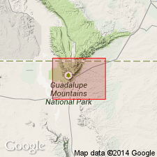
Pg. 582, 585 (fig. 7), pl. 2. Hegler limestone member of Bell Canyon formation of Delaware Mountain group. Along foot of reef escarpment is a dark-gray lumpy, slabby limestone about 15 feet thick. In Delaware Mountains, straight-bedded, platy limestones occupy same position. Lies below Pinery limestone member; base of the Hegler marks lower boundary of formation; it is oldest bed to grade northwestward into the Capitan limestone. Overlies Manzanita limestone member of Cherry Canyon formation. Age is Late Permian (Guadalupe).
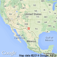
Named from Hegler Ranch, 6 mi east-northeast of Guadalupe Peak, near foot of reef escarpment, Culberson Co., western TX.
Source: US geologic names lexicon (USGS Bull. 1200, p. 1720).
- Usage in publication:
-
- Hegler limestone member*
- Modifications:
-
- Mapped 1:48k
- Dominant lithology:
-
- Limestone
- Sandstone
- AAPG geologic province:
-
- Permian basin
Summary:
Pg. 54-55, pl. 3. Hegler limestone member of Bell Canyon formation. In southeast part of southern Guadalupe Mountains, consists of 30 to 40 feet of dark-gray, fine-grained limestone in beds a few inches thick, interbedded with platy sandstone. Mapped in New Mexico. Age is Late Permian (Guadalupe).
Source: US geologic names lexicon (USGS Bull. 1200, p. 1720).
For more information, please contact Nancy Stamm, Geologic Names Committee Secretary.
Asterisk (*) indicates published by U.S. Geological Survey authors.
"No current usage" (†) implies that a name has been abandoned or has fallen into disuse. Former usage and, if known, replacement name given in parentheses ( ).
Slash (/) indicates name conflicts with nomenclatural guidelines (CSN, 1933; ACSN, 1961, 1970; NACSN, 1983, 2005, 2021). May be explained within brackets ([ ]).