


- Usage in publication:
-
- Heebner shale bed
- Modifications:
-
- Original reference
- Dominant lithology:
-
- Shale
- AAPG geologic province:
-
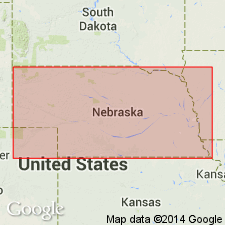
- Nemaha anticline
Summary:
Pg. 32, 33, 37. Heebner shale bed of Oread limestone member of Douglas formation. Underlies Plattsmouth limestone and overlies Leavenworth limestone. Top part is bluish and argillaceous; lower part is black, finely bedded, and somewhat carbonaceous. Thickness 5 feet or more. Age is Late Pennsylvanian (Missouri age). Report includes cross sections, measured sections, geologic maps, stratigraphic tables.
Type locality: 2.5 mi west and 1.5 mi north of Nehawka, Cass Co., southeastern NE. Named from Heebner Creek and Heebner farm, west of Nehawka, Cass Co., southeastern NE.
Source: US geologic names lexicons (USGS Bull. 896, p. 934; USGS Bull. 1200, p. 1719); GNC KS-NE Pennsylvanian Corr. Chart, sheet 1, Oct. 1936; supplemental information from GNU records (USGS DDS-6; Denver GNULEX).
- Usage in publication:
-
- Heebner shale bed
- Modifications:
-
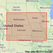
- Areal extent
Summary:
Pg. 11. Heebner shale bed of Oread limestone member of Douglas formation. Thickness 3.5 to 6 feet. Overlies Leavenworth limestone bed and underlies Plattsmouth limestone bed, both of Oread. Age is Late Pennsylvanian (Missouri age). The so-called Heebner of Bull. 1 Nebraska Geol. Survey is Galesburg shale member.
Source: US geologic names lexicon (USGS Bull. 896, p. 934); GNC KS-NE Pennsylvanian Corr. Chart, sheet 1, Oct. 1936.

- Usage in publication:
-
- Heebner shale member
- Modifications:
-
- Areal extent
Summary:
Pg. 12. Heebner shale member of Oread limestone of Shawnee group. Continued to use Heebner shale for the shale underlying Plattsmouth limestone and overlying Leavenworth limestone, and R.C. Moore also used it in Kansas in his 1936 classification. Age is Late Pennsylvanian (Virgil).
Source: US geologic names lexicon (USGS Bull. 896, p. 934); GNC KS-NE Pennsylvanian Corr. Chart, sheet 1, Oct. 1936.
- Usage in publication:
-
- Heebner shale member*
- Modifications:
-
- Overview
Summary:
Pg. 2035 (fig. 5); 1949, Kansas Geol. Survey Bull., no. 83, p. 126 (fig. 22), 148-149. Heebner shale member of Oread formation. Underlies Plattsmouth member; overlies Leavenworth limestone member. Age is Late Pennsylvanian (Virgilian). This is classification agreed upon by State Geol. Surveys of Iowa, Kansas, Missouri, Nebraska, and Oklahoma, May 1947.
Source: US geologic names lexicon (USGS Bull. 1200, p. 1719).
- Usage in publication:
-
- Heebner shale member*
- Modifications:
-
- Areal extent
- AAPG geologic province:
-
- Iowa shelf
Summary:
Pg. 418 (fig. 1), 419. Heebner shale member of Oread formation. Thickness about 3 feet in section measured near Winterset, Madison County, southwestern Iowa. Age is Late Pennsylvanian (Virgilian).
Source: US geologic names lexicon (USGS Bull. 1200, p. 1719).

- Usage in publication:
-
- Heebner shale member*
- Modifications:
-
- Areal extent
- AAPG geologic province:
-
- Forest City basin
Summary:
Pg. 22, fig. 5. Heebner shale member of Oread limestone. Characteristically olive clay shale split near base by black fissile shale. Thickness 2.5 feet in Cass County; 3 feet in Adair County; 5 feet in Montgomery County, southwestern Iowa. Overlies Leavenworth limestone member; underlies Plattsmouth limestone member. Age is Late Pennsylvanian (Virgilian).
Source: US geologic names lexicon (USGS Bull. 1200, p. 1719).
- Usage in publication:
-
- Heebner shale member*
- Modifications:
-
- Areal extent
- AAPG geologic province:
-
- Forest City basin
Summary:
Pg. 40-41, pl. 1. Heebner shale member of Oread limestone. Thickness 5 to 8 feet in central and northern Douglas County, eastern Kansas; 14 to 18 feet in south-central part of county, south of Worden fault. Age is Late Pennsylvanian (Virgilian).
Source: US geologic names lexicon (USGS Bull. 1200, p. 1719).
For more information, please contact Nancy Stamm, Geologic Names Committee Secretary.
Asterisk (*) indicates published by U.S. Geological Survey authors.
"No current usage" (†) implies that a name has been abandoned or has fallen into disuse. Former usage and, if known, replacement name given in parentheses ( ).
Slash (/) indicates name conflicts with nomenclatural guidelines (CSN, 1933; ACSN, 1961, 1970; NACSN, 1983, 2005, 2021). May be explained within brackets ([ ]).