- Usage in publication:
-
- Heceta Limestone*
- Modifications:
-
- Named
- Biostratigraphic dating
- Dominant lithology:
-
- Limestone
- Conglomerate
- Sandstone
- AAPG geologic province:
-
- Alaska Southeastern region
Summary:
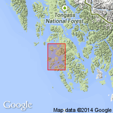
Named for exposures on Heceta Island. Type locality designated as exposures on northeast side of Warm Chuck Inlet and includes north shore of Heceta Island west of Camp Island, [55 deg 45'30" N 133 deg 30' W] southeastern AK. Also occurs on Tuxekan Island, Prince of Wales Island, Kosciusko Island, and smaller islands in Sea Otter Sound. Consists of massive limestone, mostly thick-bedded and sublithographic with local interbeds of nodular argillaceous limestone and lenses of conglomerate, sandstone, and limestone breccia in a zone near middle part of formation. Color ranges from light- to medium-dark-gray on freshly broken surfaces, locally rock may be bluish gray to grayish black, and rarely it may be mottled pink, red, chocolate, green, yellow and white. A section on western Heceta Island is a minimum of 10,000 ft thick. Conformably overlies Descon Formation (new). Conformably underlies Karheen Formation (new). Is richly fossiliferous. Assigned Middle and Late Silurian age based on biostratigraphic dating of graptolites, pelecypods, conodonts, and brachiopods.
Source: GNU records (USGS DDS-6; Menlo GNULEX).

- Usage in publication:
-
- Heceta Limestone*
- Modifications:
-
- Age modified
- Biostratigraphic dating
- AAPG geologic province:
-
- Alaska Southeastern region
Summary:
Age is late Early Silurian through Late Silurian based on biostratigraphic dating of conodonts, graptolites, and brachiopods.
Source: GNU records (USGS DDS-6; Menlo GNULEX).
For more information, please contact Nancy Stamm, Geologic Names Committee Secretary.
Asterisk (*) indicates published by U.S. Geological Survey authors.
"No current usage" (†) implies that a name has been abandoned or has fallen into disuse. Former usage and, if known, replacement name given in parentheses ( ).
Slash (/) indicates name conflicts with nomenclatural guidelines (CSN, 1933; ACSN, 1961, 1970; NACSN, 1983, 2005, 2021). May be explained within brackets ([ ]).

