

- Usage in publication:
-
- Heath formation
- Modifications:
-
- Principal reference
- Dominant lithology:
-
- Shale
- Sandstone
- AAPG geologic province:
-
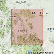
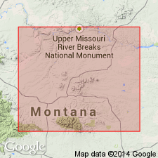
- Central Montana uplift
Summary:
Pg. 1016-1032. Heath formation of Big Snowy Group. Black, petroliferous shales and sandstones, primarily black shales, forming upper formation of Big Snowy group. Thickness may reach 500 feet. In most sections 3 sandstone beds occur in upper half. On southeastern flank of Big Snowy Mountains these sandstone beds have been grouped under name Van Dusen sand, which should be considered a member at top of Heath formation. On northeastern flank of Big Snowy Mountains sandstone beds occupying same stratigraphic zone, at top of Heath formation, have been named by O.W. Freeman, Tyler sand. It also should be treated as a member of Heath formation. The formation conformably underlies Amsden formation and conformably overlies Otter formation. Type section is on northern flank of Big Snowy Mountains, in sec. 6, T. 12 N. R. 20 E. Fossils listed. Are closely related to fauna of Brazer limestone of Idaho and Moorefield formation of Arkansas; and are not older than Warsaw nor younger than Upper Chester. Fauna is now being studied. [Age is Mississippian.]
Source: US geologic names lexicon (USGS Bull. 896, p. 933).
- Usage in publication:
-
- Heath formation*
- Modifications:
-
- Contact revised
- Overview
- AAPG geologic province:
-
- Central Montana uplift
Summary:
Is one of six formations assigned to the Big Snowy group (which previously included only three formations). Overlies Otter formation of Big Snowy; lower Heath is gray to black shale; upper Otter is concealed in a section measured in T11N, Rs20 and 21E, Golden Valley and Musselshell Cos, MT on the Central Montana uplift. Upper contact revised in that Heath underlies the newly named Cameron Creek formation of Big Snowy; basal Cameron Creek is gray and white, salt-and-pepper sandstone and upper Heath is covered in the measured section. Cross sections. Nomenclature chart. In the section, Heath consists mostly of gray to black shale and gray to black limestone. Limestone may be silty, poorly bedded, fossiliferous. Includes some gray calcareous siltstone, black to gray dense massive dolomite, and gray fossiliferous claystone. A one ft thick yellow, gray, mottled very calcareous conglomerate of angular to subangular lime-pebbles 89 ft below top of Heath. Late Mississippian age.
Source: GNU records (USGS DDS-6; Denver GNULEX).
- Usage in publication:
-
- Heath Formation*
- Modifications:
-
- Revised
- AAPG geologic province:
-
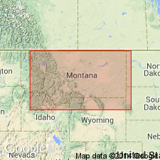
- Williston basin
- Powder River basin
- Central Montana uplift
Summary:
Is upper formation of revised Big Snowy Group, a group restricted to Kibbey, Otter, and Heath Formations, all of Chester, or Late Mississippian age. Heath restricted to exclude the sandstone and black shale above the regional unconformity which are reassigned to Stonehouse Canyon Member (new) of Tyler Formation of Amsden Group (rank raised). This same upper contact was selected by Beekly (1955) and by Mundt (1956). As so restricted is 76 ft thick at type. Is 551 ft thick at Potter Dome. As restricted is a gray to black marine petroliferous limestone, and locally, beds of gypsum. Map shows areal limits in Williston basin, Central Montana uplift, and Powder River basin. Contains a fauna of late Chester, Late Mississippian age. Cross sections. Correlation chart. Measured sections.
Source: GNU records (USGS DDS-6; Denver GNULEX).
- Usage in publication:
-
- Heath Formation
- Modifications:
-
- Revised
- AAPG geologic province:
-
- Central Montana uplift
Summary:
Middle part in Forestgrove area and south, Fergus Co, MT on the Central Montana uplift, named informally "Forestgrove member." Forestgrove divided into (ascending): Potter Creek coal bed, new (base); interbedded shale and limestone unit (middle); and "Loco Ridge gypsum bed", new (top). Cox Ranch oil shale bed in middle of middle part of Forestgrove named. Heath ranges from 160 to 290 ft thick. Of Mississippian age. Isopach map. Measured sections. Correlation diagram.
Source: GNU records (USGS DDS-6; Denver GNULEX).
For more information, please contact Nancy Stamm, Geologic Names Committee Secretary.
Asterisk (*) indicates published by U.S. Geological Survey authors.
"No current usage" (†) implies that a name has been abandoned or has fallen into disuse. Former usage and, if known, replacement name given in parentheses ( ).
Slash (/) indicates name conflicts with nomenclatural guidelines (CSN, 1933; ACSN, 1961, 1970; NACSN, 1983, 2005, 2021). May be explained within brackets ([ ]).