

- Usage in publication:
-
- Heard Group
- Modifications:
-
- Named
- Dominant lithology:
-
- Schist
- Metagraywacke
- AAPG geologic province:
-
- Piedmont-Blue Ridge province
Summary:
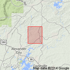
A 4- to 16-mi-wide band of metasedimentary rocks, southeast of the Wedowee Group, is here named the Heard Group, for Heard Co., GA. Previously mapped as Ashland Mica Schist, but rocks are quite different lithologically from the type Ashland in Clay and Coosa Cos., AL. They appear to underlie the Wedowee in Heard Co., while the Ashland is considered a high rank equivalent of the Wedowee. The new Heard Group in the southern part of the Tallapoosa block can be subdivided into three mappable formations: the Centralhatchee (southeasternmost), the Glenloch, and the Roopville (northernmost) Formations. The three metasedimentary formations consist essentially of metapellites and metagraywackes and all extend into AL. Age given as Precambrian and early Paleozoic.
Source: GNU records (USGS DDS-6; Reston GNULEX).
- Usage in publication:
-
- Heard Group
- Modifications:
-
- Age modified
- AAPG geologic province:
-
- Piedmont-Blue Ridge province
Summary:
Age according to geochronology of G.S. Russell is Cambrian or older.
Source: GNU records (USGS DDS-6; Reston GNULEX).
- Usage in publication:
-
- Heard Group†
- Modifications:
-
- Abandoned
- AAPG geologic province:
-
- Piedmont-Blue Ridge province
Summary:
Emuckfaw Formation is elevated to group status because of its lithologic diversity and areal extent, and divided informally into Josie Leg and Timbergut formations, which correspond to the northern and southern Heard Group as described by Muangnoicharoen (1975: Univ. of AL, M.S. thesis). Therefore, according to authors, Heard Group should be abandoned. [Unclear as to whether or not they are extending the Emuckfaw into GA. Assumed, at this time, that Heard Group is restricted only from AL, the area of study.]
Source: GNU records (USGS DDS-6; Reston GNULEX).
For more information, please contact Nancy Stamm, Geologic Names Committee Secretary.
Asterisk (*) indicates published by U.S. Geological Survey authors.
"No current usage" (†) implies that a name has been abandoned or has fallen into disuse. Former usage and, if known, replacement name given in parentheses ( ).
Slash (/) indicates name conflicts with nomenclatural guidelines (CSN, 1933; ACSN, 1961, 1970; NACSN, 1983, 2005, 2021). May be explained within brackets ([ ]).